Sainte-Anne-du-Sault, Administrative sector in Arthabaska, Quebec, Canada.
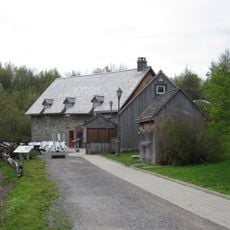
Sainte-Anne-du-Sault is an administrative sector in Centre-du-Quebec that spreads across rural land shaped by forests and farmland. The area is modest in size with scattered buildings and simple roads connecting the small communities within it.
The area was officially established as a municipality in the late 1800s, taking its name from a local church and natural feature. It remained a separate administrative entity for more than a century before administrative changes occurred.
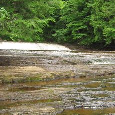
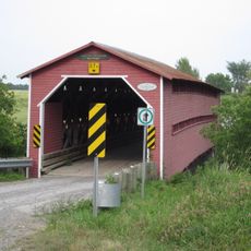
The name refers to Saint Anne and a waterfall that once mattered to early settlers in this area. Today, you can see how the landscape still shapes how people connect with their surroundings.
Visitors reach the area most easily by using major regional roads that connect to Montreal and other nearby cities. The terrain is accessible by car and everything is fairly close together, making it easy to explore.
The waterfall that inspired the place's name was an important landmark for early settlers and shaped where people chose to live. Though modern changes have altered the original municipality, the natural landscape remains a defining feature.
Location: Arthabaska
Location: Daveluyville
Inception: January 21, 1889
Shares border with: Saint-Valère, Sainte-Eulalie, Daveluyville
GPS coordinates: 46.18330,-72.13330
Latest update: December 14, 2025 11:05
Colisée Desjardins
20.2 km
Saint-Grégoire
30.7 km
Musée Laurier
23.4 km
Église Saint-Christophe d'Arthabaska
23.7 km
Moulin Michel
27 km
Rivière-Gentilly Regional Park
15.7 km
Pont Joseph-Édouard-Perrault
27.1 km
Maison Cormier
27.6 km
Hôtel des Postes
23.2 km
Monument Jean-Rivard
28.1 km
Passerelle Armand-Vaillancourt
28.1 km
Church of St Edward
26.8 km
Wilfrid Laurier House
23.4 km
Maison Fleury
23.4 km
Pont des Raymond
22.4 km
Maison Marc-Aurèle-De Foy-Suzor-Coté
22.9 km
Daveluyville
1.9 km
Église de la Sainte-Famille
18.9 km
Site du patrimoine de l'Église-Sainte-Victoire
19.3 km
Site du patrimoine de l'Église-Saint-Christophe-d'Arthabaska
23.6 km
Parish of Saint-Christophe-d'Arthabaska cemetery
23.6 km
Pont Étienne-Poirier
19.8 km
Église Sainte-Victoire
19.3 km
Église de Saint-Sylvère
8.9 km
Église de Saint-Wenceslas
15 km
Pavillon Arthabaska
24.1 km
Maison Alfred-Paris
23.2 km
Site patrimonial de la Maison Marc-Aurèle-Plamondon
23.4 kmVisited this place? Tap the stars to rate it and share your experience / photos with the community! Try now! You can cancel it anytime.
Discover hidden gems everywhere you go!
From secret cafés to breathtaking viewpoints, skip the crowded tourist spots and find places that match your style. Our app makes it easy with voice search, smart filtering, route optimization, and insider tips from travelers worldwide. Download now for the complete mobile experience.
A unique approach to discovering new places❞
— Le Figaro
All the places worth exploring❞
— France Info
A tailor-made excursion in just a few clicks❞
— 20 Minutes