Papineau-Labelle Wildlife Reserve, Wildlife reserve in the Laurentian Mountains, Canada.
Description
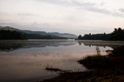
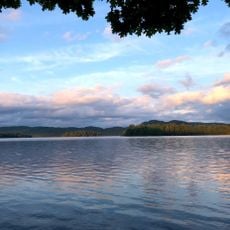
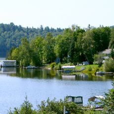
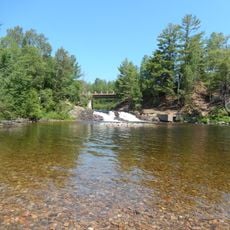
Papineau-Labelle is a wildlife reserve in the Laurentian Mountains containing more than 760 lakes and around 40 streams across mountainous terrain. The area spreads across multiple landscapes with natural waterways and forested hillsides.
History
The area experienced heavy logging from the late 1800s until around the mid-1900s. After this resource extraction ended, the territory received official protected status in 1971.
Culture
The name honors Louis-Joseph Papineau, a Quebec political figure, and Antoine Labelle, a priest who promoted settlement in the Laurentians. These two names represent key individuals who shaped the region's development.
Practical
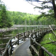
Access is available at around 15 entry points where visitors must register and can rent equipment. Canoes, kayaks, and bicycles are available for use, along with fishing permits.
Did you know?
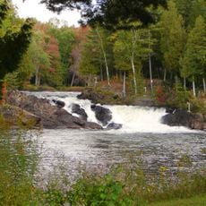
The reserve is crossed by two major river systems: the Petite-Nation River and the Sourd River. These waterways support different fish species including brook trout and northern pike.
AroundUs brings together thousands of curated places, local tips, and hidden gems, enriched daily by 60,000 contributors worldwide. Discover all places nearby (Antoine-Labelle).
Lac du Poisson Blanc
33.8 kmPoisson-Blanc Regional Park
30.2 km
Forêt-la-Blanche Ecological Reserve
39.2 km
Pont Macaza
49.3 km
Chutes à Joubert
35.8 km
Église Notre-Dame-du-Mont-Carmel
17 km
Cimetière des Soeurs de la Providence
44 km
Église Saint-Félix-de-Valois
28.3 km
Église anglicane Saint-John-in-the-Wilderness
47.2 km
Saint John Anglican Church
49.1 km
Site patrimonial de la Paroisse-de-Notre-Dame-des-Anges
34.8 km
Cimetière de Notre-Dame-de-la-Consolation
27.1 km
Réservoir l'Escalier
38.4 km
Saint-André-Avellin Church
43.8 km
Grotte de la Maison de Pierre
46.3 km
Chute aux Épinettes Rouges
17.5 km
Hôtel Petite-Nation
44.1 km
Croix de chemin de la Rouge
50.5 km
Ancien presbytère de Notre-Dame-de-la-Consolation
27 km
Ensemble institutionnel des Sœurs de la Providence
43.8 km
Sanctuaire du Mont-Saint-Joseph
43.9 km
Site patrimonial de la Place-de-l'Église-de-Saint-André-Avellin
43.8 km
Croix de chemin de la côte des Cascades
50.1 km
Croix de chemin du rang Sainte-Julie Ouest
41.5 km
Croix de chemin du rang Saint-Louis
45.2 km
Croix de chemin de la rue Saint-André
43.7 km
Pont Est de Ferme-Rouge
39.8 km
Ancienne école de Notre-Dame-de-Fatima
29.9 kmDiscover hidden gems everywhere you go!
From secret cafés to breathtaking viewpoints, skip the crowded tourist spots and find places that match your style. Our app makes it easy with voice search, smart filtering, route optimization, and insider tips from travelers worldwide. Download now for the complete mobile experience.
A unique approach to discovering new places❞
— Le Figaro
All the places worth exploring❞
— France Info
A tailor-made excursion in just a few clicks❞
— 20 Minutes