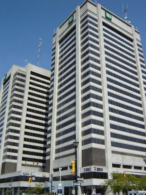
City Centre Towers, Twin office towers in London, Ontario, Canada
City Centre Towers is an office complex in London, Ontario, made up of two tall buildings connected at the base. The South tower rises to 96 meters across 23 floors while the North tower reaches 89 meters with 19 floors.
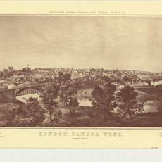
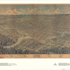
City Centre Towers opened in 1974 as the first major high-rise complex in London, Ontario. The development marked a turning point in how the city's downtown area looked and functioned.
The towers represent a central gathering point for business activities in London, Ontario, with TD Bank occupying a substantial portion of office spaces.
The complex is served by 11 elevators providing access throughout both towers. Visitors can enter through ground-level entrances and navigate easily between the connected buildings.
The buildings provide 50,118 square meters of office space across both towers, making it the second tallest structure in London, Ontario.
Location: Ontario
Inception: 1974
GPS coordinates: 42.98570,-81.24660
Latest update: December 12, 2025 17:45
Victoria Park
380 m
One London Place
0 m
Grand Theatre
367 m
Centennial Hall
384 m
Plan of laying out the ground of Publick Square, London
138 m
London C.W. Sketch of Country
312 m
Map of the City of London Canada West
312 m
Plan of the Town of London, CW, Published by The Craig, London, 1846
138 m
Map of the Township of London, Canada West, 1863
138 m
London CW
312 m
Crown Lands Dept Plan of London
312 m
Sketch of part of the London Township
138 m
Features of North Central London in the 1840s
312 m
Plan of London shewing the gas lamps
138 m
London, Canada West
312 m
Map of the city of London, surveyed and drawn by Sam'l Peters, P.L.S., published by Geo. Railton, for the London Directory, 1856
138 m
London, Canada West, 1840-1841
138 m
330 Clarence Street
398 m
Bird's Eye View of London, Ontario, Canada, 1872
312 m
308 Princess Avenue
454 m
496 Waterloo Street
411 m
London Mechanics' Institute
162 m
The Site of London
138 m
Former Toronto Dominion Bank Building
152 m
Elsie Perrin Williams Memorial Library
214 m
Ontario and Quebec Ry. Detroit Extension Plan and Profile of Right-of-way Through the City of London, West of Richmond Street
312 m
Sketch of the position of London, U.C. Nov'r 1839
138 m
Plan of London
312 mVisited this place? Tap the stars to rate it and share your experience / photos with the community! Try now! You can cancel it anytime.
Discover hidden gems everywhere you go!
From secret cafés to breathtaking viewpoints, skip the crowded tourist spots and find places that match your style. Our app makes it easy with voice search, smart filtering, route optimization, and insider tips from travelers worldwide. Download now for the complete mobile experience.
A unique approach to discovering new places❞
— Le Figaro
All the places worth exploring❞
— France Info
A tailor-made excursion in just a few clicks❞
— 20 Minutes