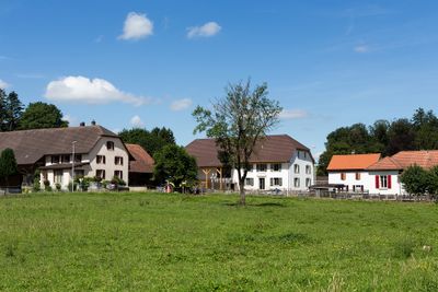
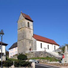
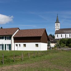
Lugnez, Rural settlement in Damphreux-Lugnez, Switzerland.
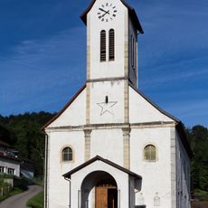
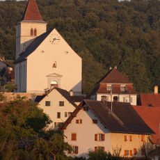
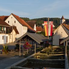
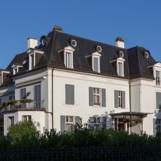
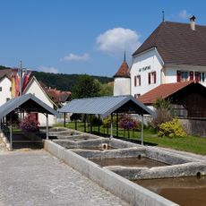
Lugnez is a rural settlement in Switzerland built across rolling terrain with extensive agricultural fields. The village has a scattered layout with farmhouses spread throughout rather than a concentrated center.
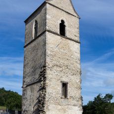
This settlement first appeared in written records between 500 and 600 CE under the name Lugduniaco, indicating very early occupation. Over the centuries the name changed, becoming Lunigie by 1225.
French language and traditions shape daily life here, visible in local signs and conversations. This cultural foundation blends with German and Portuguese influences brought by residents from different backgrounds.
The settlement is best explored by car or on foot since buildings are spread across the landscape rather than clustered together. Expect limited services and facilities typical of a quiet rural area where agriculture remains the main activity.
The municipal coat of arms displays an unusual pattern with bent lines set against silver, serving as a distinctive symbol for the place. This particular heraldic design is one of few of its kind and sets this location apart from neighboring communities.
Location: Damphreux-Lugnez
GPS coordinates: 47.48467,7.09587
Latest update: December 14, 2025 14:43
Borne des Trois Puissances
3.3 km
Moulin de Courtelevant
3.6 km
Aussichtsturm Mont Renaud
4.8 km
Milandre Tower
6.1 km
Vergers D'Ajoie
6.3 km
Église Saint-Jean-Baptiste de Réchésy
2.9 km
Église Sainte-Agathe de Courcelles
2.1 km
Église Saint-Étienne de Courtelevant
3.6 km
Église Saint-Urs-et-Saint-Sébastien de Faverois
6.1 km
Église Saint-Géréon de Pfetterhouse
5.1 km
Église Saint-Nicolas de Lepuix-Neuf
6.1 km
Chapelle de cimetière de Réchésy
2.9 km
Église de la Présentation-de-la-Vierge de Florimont
3.5 km
Former priory of Grandgourt
3.9 km
St-Laurent Church
3.9 km
Church Saint-Jacques
3.3 km
Saint-Jean-l’Évangeliste church
5.8 km
Town hall
6.3 km
Former bell tower
5.9 km
Saint-Jean church (Gothic tower) and rectory
3.4 km
Saint-Ferréol-et-Ferjeux church
1 km
Ancienne église de Florimont
3.6 km
Former lavoirs
3.6 km
Ancien local communal près du pont
6.2 km
Home des Colombes
6.3 km
Château
3.5 km
Chapelle funéraire de la Vierge-des-Douleurs abritant les tombeaux des prêtres de Pfetterhouse
5.5 km
Chapelle de la Sainte-Vierge-Marie de Pfetterhouse
5.7 kmVisited this place? Tap the stars to rate it and share your experience / photos with the community! Try now! You can cancel it anytime.
Discover hidden gems everywhere you go!
From secret cafés to breathtaking viewpoints, skip the crowded tourist spots and find places that match your style. Our app makes it easy with voice search, smart filtering, route optimization, and insider tips from travelers worldwide. Download now for the complete mobile experience.
A unique approach to discovering new places❞
— Le Figaro
All the places worth exploring❞
— France Info
A tailor-made excursion in just a few clicks❞
— 20 Minutes