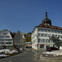
Mittelland District, former district of the canton of Appenzell Ausserrhoden, Switzerland
Location: Appenzell Ausserrhoden
Elevation above the sea: 873 m
GPS coordinates: 47.38333,9.38333
Latest update: April 6, 2025 20:04
Grubenmann-Museum
917 m
Reformed church
804 m
Alte Rotbachbrücke
483 m
Zeughaus Teufen
919 m
Wallfahrtskirche Maria Hilf
2 km
Factory building
1.7 km
Former mill
1.7 km
Farmhouse
2 km
Goldibach bridge (1805)
859 m
Factory building
1.7 km
Farmhouse
1.9 km
Farmhouse
2.2 km
Former powder tower
611 m
Farmhouse
1.6 km
Farmhouse
1.7 km
Farmhouse
885 m
Farmhouse
2.2 km
Farmhouse
1.6 km
Former mill
1.3 km
Factory building
1.7 km
Farmhouse
1.5 km
Former weaver's house
2 km
Covered bridge «Rotenbrücke« (1862)
1.4 km
Factory building
1.7 km
Heiden house
1.8 km
Tätschdach house (1539)
1.4 km
Residential building
2 km
Farmhouse in Bühler, Nord 72
2.2 kmReviews
Visited this place? Tap the stars to rate it and share your experience / photos with the community! Try now! You can cancel it anytime.
Discover hidden gems everywhere you go!
From secret cafés to breathtaking viewpoints, skip the crowded tourist spots and find places that match your style. Our app makes it easy with voice search, smart filtering, route optimization, and insider tips from travelers worldwide. Download now for the complete mobile experience.
A unique approach to discovering new places❞
— Le Figaro
All the places worth exploring❞
— France Info
A tailor-made excursion in just a few clicks❞
— 20 Minutes