Enable Location

We need your location to show you interesting places around you

Discover nearby places

Find interesting locations and hidden gems around you

Precise directions

Get accurate directions and distances to places

Your location is never shared with other users. It's only used when you tap the location button.

Log in to your account

Start exploring — it's free

Trusted by 62,892 travelers worldwide

Continue with Google
Continue with Apple
or

We will send you a code to connect

By continuing, you accept our Terms and Conditions and our Privacy Policy

Check your inbox

We've sent a pincode in your inbox. Please enter the code below.

Verwaltungsgemeinschaft Dohna-Müglitztal
Discussion Reviews Photo
900+ Popularity

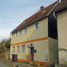
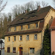
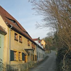
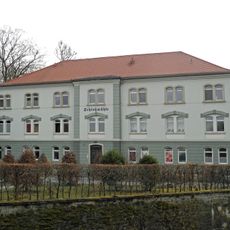
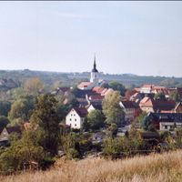
Verwaltungsgemeinschaft Dohna-Müglitztal, administrative community in the Free State of Saxony, Germany

The community of curious travelers

AroundUs brings together thousands of curated places, local tips, and hidden gems, enriched daily by 60,000 contributors worldwide.

Start exploring
Inception
January 1, 2000
GPS coordinates
50.95000,13.85000
Latest update
March 4, 2025 06:42
Around this place
Dohna Castle
Germany

Dohna Castle

459 m
Spargründe bei Dohna
Germany

Spargründe bei Dohna

54 m
Marienkirche
Germany

Marienkirche

689 m
Fabrikantenvilla Altenberger Straße 4
Germany

Fabrikantenvilla Altenberger Straße 4

599 m
Burg Dohna, Burgschänke Pfarrstraße 6
Germany

Burg Dohna, Burgschänke Pfarrstraße 6

501 m
Fleischerbrunnen
Germany

Fleischerbrunnen

726 m
Wohnhaus in offener Bebauung, Nebengebäude und Einfriedungsmauer Pfarrstraße 2
Germany

Wohnhaus in offener Bebauung, Nebengebäude und Einfriedungsmauer Pfarrstraße 2

641 m
Wohnhaus in halboffener Bebauung Pfarrstraße 8
Germany

Wohnhaus in halboffener Bebauung Pfarrstraße 8

614 m
Wohnhaus in offener Bebauung Müglitztalstraße 2
Germany

Wohnhaus in offener Bebauung Müglitztalstraße 2

508 m
Pfarrhof mit Pfarrhaus (über U-förmigem Grundriss), Einfriedung und Torbogen Pfarrstraße 1
Germany

Pfarrhof mit Pfarrhaus (über U-förmigem Grundriss), Einfriedung und Torbogen Pfarrstraße 1

646 m
Wohnhaus in offener Bebauung Dippoldiswalder Straße 6
Germany

Wohnhaus in offener Bebauung Dippoldiswalder Straße 6

514 m
Wohnhaus einschließlich Schuppengebäude Pfarrstraße 3
Germany

Wohnhaus einschließlich Schuppengebäude Pfarrstraße 3

608 m
Wohnhaus in geschlossener Bebauung (ehem. Freigut) Am Markt 10
Germany

Wohnhaus in geschlossener Bebauung (ehem. Freigut) Am Markt 10

713 m
Wohnhaus in halboffener Bebauung Dippoldiswalder Straße 21
Germany

Wohnhaus in halboffener Bebauung Dippoldiswalder Straße 21

707 m
Wohnhaus (ehemals mit Gaststätte) in offener Bebauung Dippoldiswalder Straße 11
Germany

Wohnhaus (ehemals mit Gaststätte) in offener Bebauung Dippoldiswalder Straße 11

416 m
Wohnhaus in offener Bebauung, ehemalige Schule Pfarrstraße 11
Germany

Wohnhaus in offener Bebauung, ehemalige Schule Pfarrstraße 11

638 m
Wohnhaus in offener Bebauung Pfarrstraße 12
Germany

Wohnhaus in offener Bebauung Pfarrstraße 12

637 m
Müglitztalbahn (Sachgesamtheit); Brücke Sürßener Weg Gamig
Germany

Müglitztalbahn (Sachgesamtheit); Brücke Sürßener Weg Gamig

318 m
Wohnhaus in offener Bebauung Dippoldiswalder Straße 4
Germany

Wohnhaus in offener Bebauung Dippoldiswalder Straße 4

573 m
Wohnhaus in geschlossener Bebauung Dippoldiswalder Straße 22
Germany

Wohnhaus in geschlossener Bebauung Dippoldiswalder Straße 22

706 m
Wohnhaus in offener Bebauung Dippoldiswalder Straße 7
Germany

Wohnhaus in offener Bebauung Dippoldiswalder Straße 7

482 m
Wohnhaus in offener Bebauung Pfarrstraße 9
Germany

Wohnhaus in offener Bebauung Pfarrstraße 9

634 m
Wohnhaus in halboffener Bebauung Dippoldiswalder Straße 23
Germany

Wohnhaus in halboffener Bebauung Dippoldiswalder Straße 23

707 m
Wohnhaus in offener Bebauung Dippoldiswalder Straße 5
Germany

Wohnhaus in offener Bebauung Dippoldiswalder Straße 5

526 m
Wohnhaus in offener Bebauung Dippoldiswalder Straße 10
Germany

Wohnhaus in offener Bebauung Dippoldiswalder Straße 10

420 m
Wohnhaus (zwei Hausteile) in halboffener Bebauung Dippoldiswalder Straße 17
Germany

Wohnhaus (zwei Hausteile) in halboffener Bebauung Dippoldiswalder Straße 17

618 m
Rathaus Am Markt 11
Germany

Rathaus Am Markt 11

685 m
Schlossmühle Dohna
Germany

Schlossmühle Dohna

354 m
Show the full map
Administrative divisions
« Verwaltungsgemeinschaft Dohna-Müglitztal - administrative community in the Free State of Saxony, Germany » is provided by Around Us (aroundus.com). Images and texts are derived from Wikimedia project under a Creative Commons license. You are allowed to copy, distribute, and modify copies of this page, under the conditions set by the license, as long as this note is clearly visible.

Discover hidden gems everywhere you go!

From secret cafés to breathtaking viewpoints, skip the crowded tourist spots and find places that match your style. Our app makes it easy with voice search, smart filtering, route optimization, and insider tips from travelers worldwide. Download now for the complete mobile experience.

Around Us App Screenshot

A unique approach to discovering new places

Le Figaro

All the places worth exploring

France Info

A tailor-made excursion in just a few clicks

20 Minutes

Around Us
Travel Guide & Maps
Download

Send to your phone

QR Code
1

Open the camera app on your mobile.

2

Point at the QR code with your camera. A notification will appear.

3

Tap the notification to open the link.