Dohna Castle, Medieval castle ruins in Dohna, Germany.
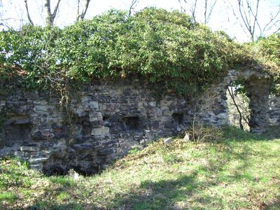
Dohna Castle is a ruined fortress on Schlossberg hill, on the edge of the town of Dohna in Saxony, Germany. Its remaining stone walls trace the outline of a double fortification, with a separate inner zone and an outer defensive ring still visible today.
The fortress was founded around 950 under Emperor Otto I to secure a key trade route between Saxony and Bohemia. After the Dohna Feud of 1402, when it was captured and damaged, it slowly lost its military role and was never fully rebuilt.
The name Dohna comes from the Slavic word "Doena", which points to the area's pre-German roots and is still carried by the town below. Visitors walking through the ruins can see how the different defensive zones were laid out to watch over the valley and the roads crossing it.
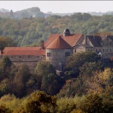
Marked trails lead up Schlossberg hill to the ruins, which can be visited throughout the year. The path can become slippery after rain, so sturdy footwear is a good idea before heading up.
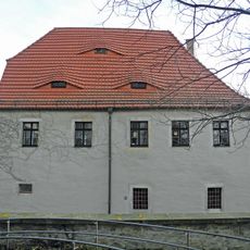
A round tower built in 1830 stands inside the old fortress walls, clearly different in style from the medieval stonework around it. It was later turned into a small museum holding regional objects and local governance records.
The community of curious travelers
AroundUs brings together thousands of curated places, local tips, and hidden gems, enriched daily by 60,000 contributors worldwide.