Weisseritz Valley Railway, Narrow gauge railway in Sächsische Schweiz-Osterzgebirge, Germany.
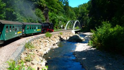
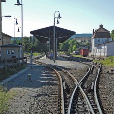
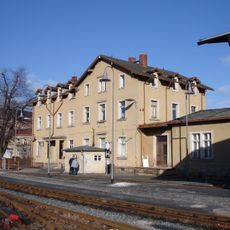
The Weisseritz Valley Railway is a narrow gauge line running through the eastern Ore Mountains, linking Freital-Hainsberg with the spa town of Kurort Kipsdorf. The route travels through hilly terrain, crosses multiple bridges, and follows the Red Weißeritz river while climbing about 350 meters in elevation.
The line opened in 1882 to transport raw materials and goods from the mining and industrial region. In 1912, the track was relocated to make room for the construction of the Malter Valley Dam.
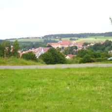
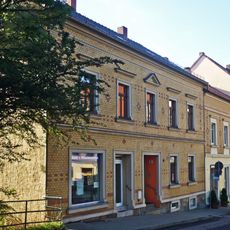
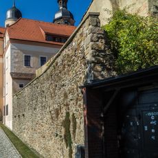
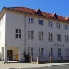
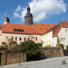
The railway connects visitors to the story of mining and craftsmanship traditions that shaped the communities along its route for generations. Travelers can observe how the surrounding landscape reflects the economic and social patterns that developed over time in these villages.
The railway operates daily with steam locomotives and provides space for bicycles in dedicated cars. In adverse weather, trains continue running, but it is wise to bring weather-appropriate clothing and arrive early to secure good seats.
Trains travel at about 30 kilometers per hour, allowing passengers to observe the passing landscape at a leisurely pace. This slow speed transforms the journey into a meditative experience where details of the forests and valleys become clearly visible.
Location: Sächsische Schweiz-Osterzgebirge
Part of: Narrow gauge railways in Saxony
Address: Hainsberg
Website: http://weisseritztalbahn.de
GPS coordinates: 50.89103,13.66454
Latest update: December 7, 2025 19:22
Schloss Dippoldiswalde
529 m
Saints Mary and Lawrence Church
550 m
St. Nikolai
119 m
Museum for Medieval Mining in the Ore Mountains
529 m
Handels- und Gewerbeschule mit Skulpturenportal, Türblatt und Einfriedung Weißeritzstraße 4
397 m
Wohnhaus in halboffener Bebauung Bahnhofstraße 3
409 m
Bogenbrücke über den Mühlgraben Alte Altenberger Straße 18 (bei)
159 m
Bahnhof Dippoldiswalde
16 m
Polish-Saxon Post Milestone Pfortenberg Dippoldiswalde
524 m
'''Bahnhof Dippoldiswalde''' (Einzeldenkmal zu ID-Nr. 09301537) An der Kleinbahn 2
90 m
Reste der Stadtmauer Karl-Marx-Platz -
494 m
Postamt Dr.-Friedrichs-Straße 5
453 m
Wohnhaus in geschlossener Bebauung Schuhgasse 19; 21
540 m
'''Schloss Dippoldiswalde''' (Einzeldenkmal zu ID-Nr. 09301353) Kirchplatz 8
527 m
Wohnhaus in geschlossener Bebauung Kirchplatz 9
547 m
Ehemalige Superintendentur, mit Garten Kirchplatz 12
520 m
Stattliches Wohnhaus mit Eckarkatur Karl-Marx-Platz 1
512 m
Wohn- und Geschäftshaus, ehemaliges »Stadt-Kaffee« Bahnhofstraße 2; 4
377 m
Saint Nicholas Church
118 m
Postamt Bahnhofstraße 6
341 m
Sachgesamtheit Schloss Dippoldiswalde
527 m
Wohnhaus Dr.-Friedrichs-Straße 3
414 m
Ehem. Lohgerberei; Lohgerber-, Stadt- und Kreismuseum Freiberger Straße 18
205 m
Sandstein-Treppenstufen zum Mühlgraben historischer Wäscheplatz Gerberplatz 2 (bei)
274 m
Alte Pforte; Gasthaus Pfortenberg 2
489 m
Schulgebäude und Turnhalle Alte Altenberger Straße 8
445 m
Vier erhaltene Stadtscheunen Planberg -
416 m
Wohnhaus Pfortenberg 1
500 mVisited this place? Tap the stars to rate it and share your experience / photos with the community! Try now! You can cancel it anytime.
Discover hidden gems everywhere you go!
From secret cafés to breathtaking viewpoints, skip the crowded tourist spots and find places that match your style. Our app makes it easy with voice search, smart filtering, route optimization, and insider tips from travelers worldwide. Download now for the complete mobile experience.
A unique approach to discovering new places❞
— Le Figaro
All the places worth exploring❞
— France Info
A tailor-made excursion in just a few clicks❞
— 20 Minutes