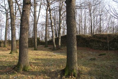
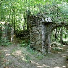
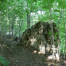
Burg Körse, Medieval castle ruins on Schlossberg, Schirgiswalde-Kirschau, Germany.
Burg Körse is a castle ruin on Schlossberg near Schirgiswalde-Kirschau with well-preserved ring walls that reach up to three meters in places. The site follows a rectangular layout with four gate structures that once guarded access to the central keep.
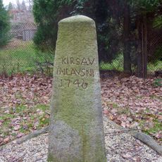
The site began around 900 as a Sorbian fortification called Korzym and was rebuilt into a stone castle by German conquerors by 1200. It became the largest defensive complex in Upper Lusatia and shaped the region for centuries.
The site was once home to Sorbian peoples and later German nobles, with each group leaving traces in how the fortification was built and rebuilt. Visitors can see these different settlement layers directly in the stonework.
The site is accessible via hiking trails that lead to different sections of the medieval fortification and remain open to the public without entry fees. Sturdy shoes are recommended as the paths are uneven and the terrain has varying elevations.
Many of the granite blocks in the ring walls bear dark burn marks from fierce sieges in the past. These scars tell of the violent conflicts that took place here.
The community of curious travelers
AroundUs brings together thousands of curated places, local tips, and hidden gems, enriched daily by 60,000 contributors worldwide.