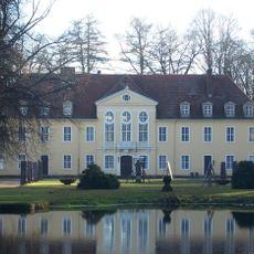
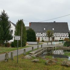
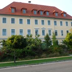
Keulenberg, Mountain summit in Pulsnitz, Germany
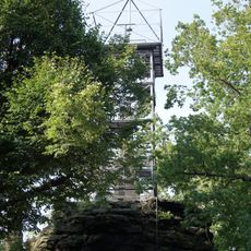
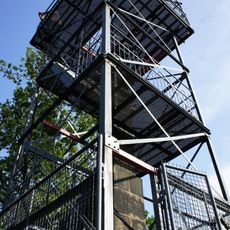
Keulenberg is a mountain in Pulsnitz consisting of two summits connected by a wide saddle, with the main peak reaching 413 meters. The two peaks create a distinctive double shape that is visible from many points in the surrounding landscape.
The mountain served as a geographical landmark for centuries, marking territorial boundaries between different Saxon administrative districts. Its distinctive shape made it a reliable reference point in the landscape of Upper Lusatia.
The mountain serves as a gathering place where people come together for seasonal celebrations and local traditions. It reflects the blend of Saxon and Lusatian customs that have shaped this region.
A viewing tower at the summit offers a 360-degree view of the Lausitzer Bergland landscape and surrounding areas. The climb is easy to reach and the tower allows you to take in the wide surroundings all at once.
The mountain is a popular spot for kite flying and paragliding thanks to its slope and elevation that create excellent wind conditions. From the summit you can often see colorful kites and gliders dancing above the landscape.
Location: Pulsnitz
Elevation above the sea: 413.4 m
GPS coordinates: 51.22725,13.95588
Latest update: December 10, 2025 20:10
Schloss Oberlichtenau
2.6 km
Kirche Höckendorf
2.8 km
Steinkreuz Gräfenhain
2.6 km
Keulenberg Observation Tower
16 m
Kirche Reichenbach
2.7 km
Kirche Oberlichtenau
2.5 km
Pulsnitzer Straße 22, Schule
3 km
Pulsnitzer Straße 8
2.4 km
Ehemalige Schule Kleindittmannsdorfer Straße 5
2.9 km
Pulsnitzer Straße 13
2.6 km
Ehemalige Schule Kleindittmannsdorfer Straße 2
2.8 km
König-Friedrich-August-Gedenkstein Keulenberg
13 m
Wohnstallhaus, Seitengebäude und Handschwengelpumpe Pulsnitztalstraße 56 (ehemals Pulsnitzer Straße 9)
2.7 km
Schloss, zwei Kavaliershäuser, Brunnenskulpturen (Flussgottheiten) am nördlichen Ende des Schlossteiches, 11 Putten sowie Skulptur des Bacchus im Ehrenhof vor dem Schloss, zwei Büsten auf Sockeln, Skulpturen der Flora und Diana sowie zwei Brunnen
2.6 km
Wegestein Am Dorfteich
2.7 km
Bismarckdenkmal; Gedenkstein Keulenberg
16 m
Evangelische Pfarrkirche mit Kirchhof, ein Grabmal an der Kirchenwand und umgebende Einfriedungsmauer mit Kirchhofstor Kleindittmannsdorfer Straße 3a
2.9 km
Pulsnitzer Straße 16
2.6 km
Wohnstallhaus und Einfriedungsmauer mit zwei Torpfosten Oberer Mühlgraben 8
2.8 km
Station 10 Keulenberg
12 m
Gasthof Großnaundorf
2.8 km
Gutshaus Höckendorf
2.9 km
Ruine des Berghäuschens Keulenberg
55 m
Pulsnitzer Straße 10
2.4 km
Pfarrhaus mit allen Bruchsteinmauern im Grundstück sowie gegenüber liegendes Backhaus (Nr. 3c) Kleindittmannsdorfer Straße 3, 3c
2.9 km
Herrenhaus des ehemaligen Lehnguts Pulsnitzer Straße 3 (Reichenbacher Straße 1)
2.9 km
Pulsnitzer Straße 21
2.7 km
Denkmal für die Gefallenen des Ersten Weltkrieges Kleindittmannsdorfer Straße
2.8 kmVisited this place? Tap the stars to rate it and share your experience / photos with the community! Try now! You can cancel it anytime.
Discover hidden gems everywhere you go!
From secret cafés to breathtaking viewpoints, skip the crowded tourist spots and find places that match your style. Our app makes it easy with voice search, smart filtering, route optimization, and insider tips from travelers worldwide. Download now for the complete mobile experience.
A unique approach to discovering new places❞
— Le Figaro
All the places worth exploring❞
— France Info
A tailor-made excursion in just a few clicks❞
— 20 Minutes