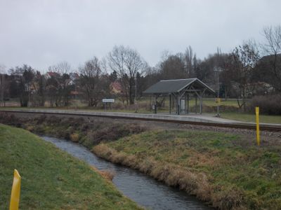
Döllnitz, Stream in Landkreis Leipzig, Germany.
The Döllnitz is a stream that flows through the Leipzig region of Saxony, meandering across the landscape for considerable distance. This waterway connects several towns and eventually flows into a larger river system.
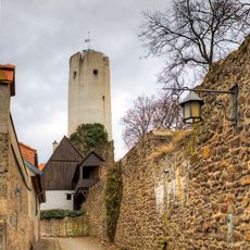
This waterway flowed through the region during the Middle Ages and provided water to the settlements that developed along its course. Its route has remained essentially unchanged throughout the centuries.
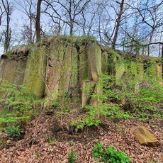
The brook is valued locally as a habitat for wildlife and plants that thrive along its banks. Residents and visitors appreciate walking along its course and observing the natural life it supports.
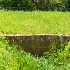
The stream flows through open countryside and can be reached from several access points, particularly near settlements. Walking conditions are best during warmer months when the paths are dry.
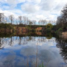
This stream feeds into an extensive water basin that supports diverse plant and animal species throughout its course. This ecological diversity makes it an important habitat for those interested in observing nature.
Location: Landkreis Leipzig
GPS coordinates: 51.28087,13.08909
Latest update: December 10, 2025 20:10
Schloss Leuben
1.8 km
Kirche Altoschatz
1.1 km
Schulgebäude mit Einfriedung Rudolf-Breitscheid-Straße 1
2 km
Root cellar Kreischaer Straße 6
216 m
Lutherbuche Stadtbibliothek
2 km
Rock cliffs in sand pit Altoschatz
1.5 km
Steinbruch Anglerparadies
1.3 km
Root cellar Kreischaer Straße 5
180 m
Straßenbrücke zum Schlossareal Leuben
1.9 km
Sachgesamtheit Dorfkirche und Kirchhof Altoschatz, mit folgenden Einzeldenkmalen: Kirche (mit Ausstattung), Einfriedung, Grabmalen, Kriegerdenkmal für die Gefallenen des 1. Weltkrieges und Leichenhalle (siehe Einzeldenkmalliste Obj. 08973850) sowie
1.1 km
Straßenbrücke
2 km
Sachgesamtheit Stadtbefestigung und Promenade mit folgenden Einzeldenkmalen: Reste der Stadtmauer mit zwei Wehrtürmen (Frongasse, bei Nr. 1 und Brüderstraße, bei Nr. 5) - (siehe Einzeldenkmalliste - Obj. 08973787) sowie gestalteter Bereich der Rin
2.1 km
Root cellar Kreischaer Straße 2
105 m
Quarry Altoschatz
1.3 km
Altoschatz Manor
1 km
Einzeldenkmale der Sachgesamtheit Stadtbefestigung und Promenade: Reste der Stadtmauer mit zwei Wehrtürmen (Frongasse, bei Nr. 1 und Brüderstraße, bei Nr. 5) - (siehe auch Sachgesamtheitsliste - Obj. 09305772)
2.1 km
Ehemalige Fronfeste (Anschrift: Altoschatzer Straße 16 und Frongasse 1) in offener Bebauung, heute Museum, mit seitlicher Pforte Altoschatzer Straße 16
2.1 km
Kriegerdenkmal
1.9 km
Mühlengebäude
2 km
Wegestein Leuben
1.9 km
War memorial for the fallen of World War I
452 m
Gedenkkreuz und Lutherbuche Rudolf-Breitscheid-Straße -
2 km
Gutsverwalterhaus Rittergut Leuben
1.9 km
Backhaus
2 km
Wiesenstraße 1
1.9 km
Scheune des ehemaligen Rittergutes Leuben
1.8 km
Rittergut Leuben
1.9 km
Gesindehaus Rittergut Leuben
1.9 kmVisited this place? Tap the stars to rate it and share your experience / photos with the community! Try now! You can cancel it anytime.
Discover hidden gems everywhere you go!
From secret cafés to breathtaking viewpoints, skip the crowded tourist spots and find places that match your style. Our app makes it easy with voice search, smart filtering, route optimization, and insider tips from travelers worldwide. Download now for the complete mobile experience.
A unique approach to discovering new places❞
— Le Figaro
All the places worth exploring❞
— France Info
A tailor-made excursion in just a few clicks❞
— 20 Minutes