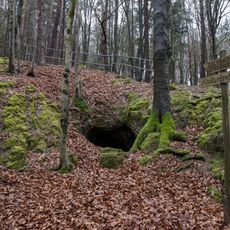
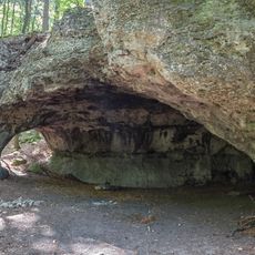
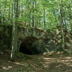
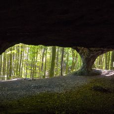
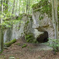
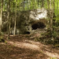
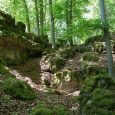
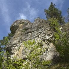
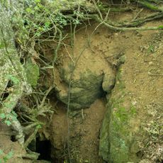
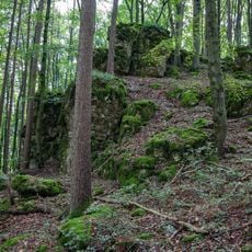
Easter Cave, Cave entrance in Neukirchen bei Sulzbach-Rosenberg, Germany
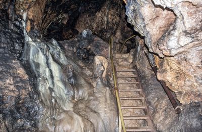
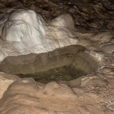
Easter Cave is a cave entrance near Neukirchen bei Sulzbach-Rosenberg that extends roughly 185 meters beneath the surface. Manganese deposits line the rock walls throughout the passages.
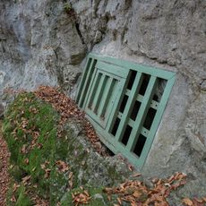
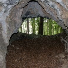
Records first documented the cave in 1630, though it remained largely inaccessible for centuries. An artificial entrance was built in 1905 to open it for public visits.
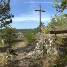
The name comes from Osterberg mountain, where the cave sits. Local tradition links this name to old Germanic heritage in the region.
The cave welcomes visitors on Saturdays from 2 PM to 5 PM and Sundays from 1 PM to 5 PM during the open season. Seasonal closures occur from November through April when conditions are less suitable.
The passages are lit using traditional carbide lamps that cast a warm, flickering glow through the chambers. This old-fashioned lighting method gives visitors an authentic experience that has changed little since early public tours began.
Accessibility: Wheelchair inaccessible
Opening Hours: November-April off; Saturday 14:00-17:00; Sunday 13:00-17:00
GPS coordinates: 49.51805,11.66452
Latest update: December 13, 2025 11:48
Burgstall Hartenfels
2.4 km
St. Petrus und Paulus
3.1 km
Cultural heritage D-3-6435-0140 in Neukirchen bei Sulzbach-Rosenberg
3.4 km
Mittlere Lupberghöhle
359 m
St. Peter und Paul
2.8 km
Simultankirche St. Margareta
3.7 km
Cultural heritage D-3-6435-0034 in Neukirchen bei Sulzbach-Rosenberg
2.4 km
Höhlen am Lenzenberg SE von Peilstein
1.2 km
Cultural heritage D-3-6435-0080 in Neukirchen bei Sulzbach-Rosenberg
2.2 km
Cultural heritage D-3-6435-0033 in Neukirchen bei Sulzbach-Rosenberg
2.8 km
Cultural heritage D-3-6435-0106 in Neukirchen bei Sulzbach-Rosenberg
17 m
Peilstein 5
1.9 km
Geiskirche bei Peilstein
1.3 km
Stadel
3.1 km
Dolomitfelsen SW von Lockenricht
737 m
Cultural heritage D-3-6435-0035 in Neukirchen bei Sulzbach-Rosenberg
2.4 km
Cultural heritage D-3-6435-0110 in Neukirchen bei Sulzbach-Rosenberg
1.1 km
Ehemaliges Forsthaus der Freudenberger
3 km
Hartenfels E von Neukirchen
2.5 km
Wohnstallbau
2.8 km
Ehemaliges evang.-lutherisches Schulhaus
2.8 km
Ehemaliger Zehntkasten, jetzt Wohnhaus
2.8 km
Wohnstallbau (Ermhof)
3.3 km
Ponordoline mit Höhle A269
3.8 km
Dolomitfelsen mit Brünlingsloch (A62) SE von Lockenricht
903 m
Gedenktafel
2.8 km
Lockenricht 6
1.2 km
Brünlingsloch
913 mVisited this place? Tap the stars to rate it and share your experience / photos with the community! Try now! You can cancel it anytime.
Discover hidden gems everywhere you go!
From secret cafés to breathtaking viewpoints, skip the crowded tourist spots and find places that match your style. Our app makes it easy with voice search, smart filtering, route optimization, and insider tips from travelers worldwide. Download now for the complete mobile experience.
A unique approach to discovering new places❞
— Le Figaro
All the places worth exploring❞
— France Info
A tailor-made excursion in just a few clicks❞
— 20 Minutes