Stadel, Bundwerkstadel des Vierseithofes, zweitennig, Erdgeschoss in Brockenmauerwerk, Ostgiebel mit Gitterfeld, Mitte 19. Jahrhundert
Location: Oberneukirchen
Address: Schmidlehen 60
GPS coordinates: 48.16722,12.50503
Latest update: November 8, 2025 03:41

Brunnen
2.6 km
Friedhofsmauer Hofmark 6 in Oberneukirchen (Oberbayern)
1.3 km
Getreidekasten
2.1 km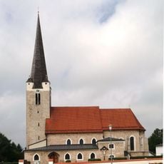
Sankt Margaretha
1.3 km
Kornspeicher Lohen 3a in Kraiburg am Inn
2.9 km
Bundwerkobergeschoss
2.9 km
Stadel
1.9 km
Stallstadel Gasteig 53 in Oberneukirchen (Oberbayern)
1.1 km
Bundwerkstadel
2.1 km
Stallstadel Garrer 115 in Oberneukirchen (Oberbayern)
1.9 km
Cultural heritage D-1-7841-0178 in Oberneukirchen (Oberbayern)
1.3 km
Bildstock
1.5 km
Bildstock
2.2 km
Stadel
1.5 km
Stadel
843 m
Bauernhaus
2.8 km
Heiligenhäuschen
1.6 km
Feldkapelle
752 m
Ehemaliges Kleinbauernhaus
1.9 km
Stadel
1.1 km
Stadel
1.6 km
Wayside cross
1.5 km
Wayside shrine
2.7 km
Wayside cross
2.2 km
Wayside cross
2.1 km
Wayside cross
1.5 km
Wayside cross
2.6 kmReviews
Visited this place? Tap the stars to rate it and share your experience / photos with the community! Try now! You can cancel it anytime.
Discover hidden gems everywhere you go!
From secret cafés to breathtaking viewpoints, skip the crowded tourist spots and find places that match your style. Our app makes it easy with voice search, smart filtering, route optimization, and insider tips from travelers worldwide. Download now for the complete mobile experience.

A unique approach to discovering new places❞
— Le Figaro
All the places worth exploring❞
— France Info
A tailor-made excursion in just a few clicks❞
— 20 Minutes