
Zittauer Mandau-Hochufer Äußere Oybiner Straße
Zittauer Mandau-Hochufer Äußere Oybiner Straße, bridge in Germany
Location: Zittau
Inception: 1850
Address: Äußere Oybiner Straße
GPS coordinates: 50.89546,14.80003
Latest update: March 6, 2025 14:53

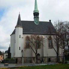
Weberkirche (Zittau)
277 m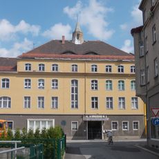
Volkshaus Zittau
299 m
Wohnhaus Innere Weberstraße 22
338 m
Grätzsches Haus Innere Weberstraße 20
347 m
Wohnhaus Breite Straße 13
332 m
Wohnhaus Mandauer Berg 1
361 m
Wohnhaus Mandauer Berg 5
354 m
Wohnhäuser Mandauer Berg 8; (10; 12)
310 m
Wohnhaus Mandauer Berg 11
317 m
Wohnhaus Zeichenstraße 27
180 m
Villa Dr.-Brinitzer-Straße 10
58 m
Heinrich-Heine-Platz 6
133 m
Wohnhaus Innere Weberstraße 44
288 m
Ehemaliges Gasthaus Mandaustraße 4
107 m
Wohnhaus Innere Weberstraße 16
366 m
Ringanlagen (Sachgesamtheit) Innere Weberstraße 41 (vor)
263 m
Wohnhaus Lindenstraße 34
366 m
Wohnhaus Brunnenstraße 9; 9a
338 m
Fassade Brunnenstraße 11
315 m
Wohnhaus Brunnenstraße 13
309 m
Wohnhaus Brunnenstraße 17
300 m
Wohnhaus Brunnenstraße 21
277 m
Wohnhaus Innere Oybiner Straße 19
138 m
Wohnhaus Innere Weberstraße 11
352 m
Wohnhaus Innere Weberstraße 38
294 m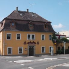
Gasthof Dresdner Hof Äußere Oybiner Straße 9
234 m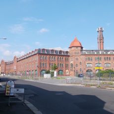
Schubertsche Weberei (ehem.) Äußere Oybiner Straße 14b; 16
352 m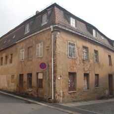
Wohnhaus Lindenstraße 17
369 mReviews
Visited this place? Tap the stars to rate it and share your experience / photos with the community! Try now! You can cancel it anytime.
Discover hidden gems everywhere you go!
From secret cafés to breathtaking viewpoints, skip the crowded tourist spots and find places that match your style. Our app makes it easy with voice search, smart filtering, route optimization, and insider tips from travelers worldwide. Download now for the complete mobile experience.

A unique approach to discovering new places❞
— Le Figaro
All the places worth exploring❞
— France Info
A tailor-made excursion in just a few clicks❞
— 20 Minutes