
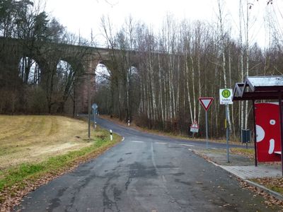
Viadukt Steina; Eisenbahnstrecke Riesa -Chemnitz Steina
Viadukt Steina; Eisenbahnstrecke Riesa -Chemnitz Steina, bridge in Germany
Location: Hartha
Inception: 1846
Address: Steina (Hartha)
GPS coordinates: 51.10191,13.02164
Latest update: March 10, 2025 12:03

JVA Waldheim
3.1 km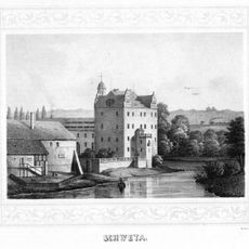
Schweta Castle
3.7 km
Bahnhof Waldheim
3.1 km
St. Nicolai (Waldheim)
3.5 km
Kirche Ziegra
2.4 km
Kirche (mit Ausstattung) sowie Treppe, Mauer und Pflasterung des Kirchhofs Schönberger Straße -
3.5 km
Kirche Hartha
3 km
Sauergrasfichten Waldheim
3.7 km
Leipziger Straße 2
3.6 km
Alte Zschopaubrücke Waldheim
3.1 km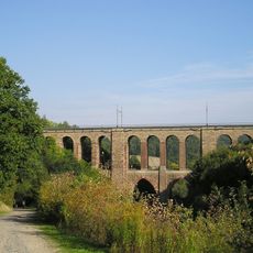
Viadukt Diedenmühle
2.4 km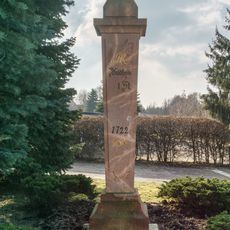
Halbmeilensäule in Hartha
3.6 km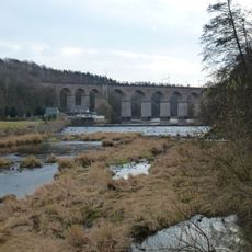
Viadukt Limmritz
1.6 km
Postmeilensäule in Waldheim
3.2 km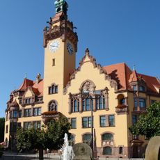
Rathaus Waldheim
3.2 km
Weststraße 29
3.6 km
Pestalozzi-Schule
3.4 km
Wohnhaus in geschlossener Bebauung Markt 10; 12
3.1 km
Wohnhaus in geschlossener Bebauung Markt 8
3.1 km
Altes Rathaus
3.1 km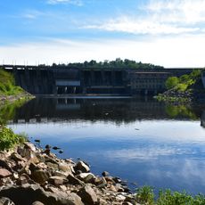
Unteres Zschopautal
2.8 km
Rathaus Hartha
3.5 km
Verwaltungsgebäude mit Einfriedung Franz-Mehring-Straße 25
3.5 km
Dresdener Straße 77, 77a
3.4 km
Kirche Nauhain
3.1 km
Mietshaus in geschlossener Bebauung Weststraße 27
3.6 km
Mietshaus in geschlossener Bebauung Weststraße 23
3.6 km
Wohnhaus in offener Bebauung Weststraße 10
3.5 kmVisited this place? Tap the stars to rate it and share your experience / photos with the community! Try now! You can cancel it anytime.
Discover hidden gems everywhere you go!
From secret cafés to breathtaking viewpoints, skip the crowded tourist spots and find places that match your style. Our app makes it easy with voice search, smart filtering, route optimization, and insider tips from travelers worldwide. Download now for the complete mobile experience.

A unique approach to discovering new places❞
— Le Figaro
All the places worth exploring❞
— France Info
A tailor-made excursion in just a few clicks❞
— 20 Minutes