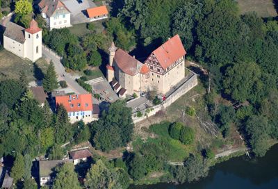
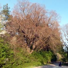
Schloss Rechenberg, Medieval castle in Stimpfach, Germany.
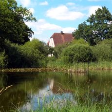
Schloss Rechenberg is a castle in Stimpfach that rises on a hilltop above a pond with a solid stone structure spanning several levels. The building displays a sturdy masonry base, a middle section with thick walls, an upper timber-framed section, and is reinforced by towers and defensive walls that once protected its interior.
The castle was founded before 1227 as a seat of the Knights of Rechenberg, who served as administrators for the Counts of Oettingen in this role until 1405. A major renovation occurred in 1571 when extensive work transformed it from a military fortress into a residential structure that shaped its current appearance.
The place held significance as a seat of power shaped by different noble families across centuries. Inhabitants experienced the transformation from a fortress into a residential castle, visible today in how the building is organized and used.
The castle is today privately owned and can be viewed from outside while respecting the property boundaries. Since it remains an inhabited place, staying on the grounds requires prior permission or a special visiting arrangement.
The building owes its present shape largely to a 1571 renovation by Heinrich Steinhäuser von Neidelfels, who added a south wing that fundamentally altered the overall structure. This work created an unusual floor plan that sets it apart from many other structures of that period.
The community of curious travelers
AroundUs brings together thousands of curated places, local tips, and hidden gems, enriched daily by 60,000 contributors worldwide.