Enable Location

We need your location to show you interesting places around you

Discover nearby places

Find interesting locations and hidden gems around you

Precise directions

Get accurate directions and distances to places

Your location is never shared with other users. It's only used when you tap the location button.

Alarcón

Log in to your account

Start exploring — it's free

Trusted by 62,060 travelers worldwide

Continue with Google
Continue with Apple
or

We will send you a code to connect

By continuing, you accept our Terms and Conditions and our Privacy Policy

Check your inbox

We've sent a pincode in your inbox. Please enter the code below.

Alarcón, Administrative division in Cuenca Province, Spain

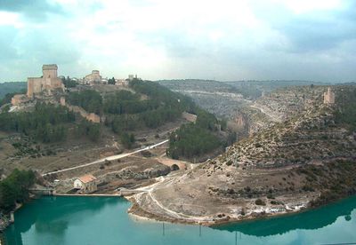
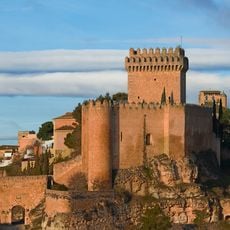
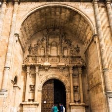
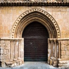
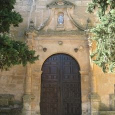
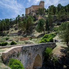
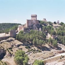
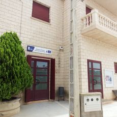
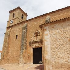
Alarcón is a municipality in Cuenca Province perched on a hilltop above the Júcar River. The town spreads across steep slopes with narrow winding streets leading to a fortified structure at its highest point.

The settlement was founded by the Moors and later became an important fortress during the medieval Christian Reconquest. The castle played a key defensive role in protecting the region from eastern threats.

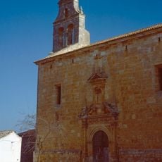
The town's name reflects its Moorish past, a heritage visible in how the settlement is laid out and built. Walking through, you notice architectural details and street patterns that echo this earlier period of the region's history.

The best way to explore this place is on foot, since narrow lanes and steep slopes make driving difficult. Wear sturdy shoes, as streets are uneven and sometimes slippery.

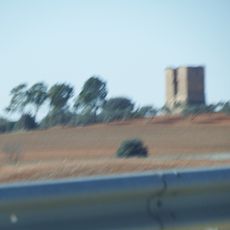
The castle was built on a narrow strip of land between two loops of the Júcar River, making it surrounded by water on three sides. This natural defensive position was one reason why the fortress was so hard to capture.

The community of curious travelers

AroundUs brings together thousands of curated places, local tips, and hidden gems, enriched daily by 60,000 contributors worldwide.

Start exploring
Location
Capital city
Alarcón
Elevation above the sea
831 m
Part of
Mancomunitat de Serveis «Manchuela Conquense»
Shares border with
Buenache de Alarcón, Cañada Juncosa, Gabaldón, Honrubia, Motilla del Palancar, Olmedilla de Alarcón, Pozorrubielos de la Mancha, Quintanar del Rey, Tébar, Valhermoso de la Fuente, Valverdejo, El Peral, Sisante, El Picazo, Casasimarro, Villalgordo del Júcar, Casas de Benítez
GPS coordinates
39.55000,-2.08333
Latest update
December 20, 2025 11:29
« Alarcón - Administrative division in Cuenca Province, Spain » is provided by Around Us (aroundus.com). Images and texts are derived from Wikimedia project under a Creative Commons license. You are allowed to copy, distribute, and modify copies of this page, under the conditions set by the license, as long as this note is clearly visible.

Discover hidden gems everywhere you go!

From secret cafés to breathtaking viewpoints, skip the crowded tourist spots and find places that match your style. Our app makes it easy with voice search, smart filtering, route optimization, and insider tips from travelers worldwide. Download now for the complete mobile experience.

Around Us App Screenshot

A unique approach to discovering new places

Le Figaro

All the places worth exploring

France Info

A tailor-made excursion in just a few clicks

20 Minutes

Around Us
Travel Guide & Maps
Download

Send to your phone

QR Code
1

Open the camera app on your mobile.

2

Point at the QR code with your camera. A notification will appear.

3

Tap the notification to open the link.