Navalcarnero

Log in to your account

AroundUs is a community-driven map of interesting places, built by curious explorers like you. It grows with every review, story, and photo you share.
Connect to save your favorite spots, contribute locations, and create personalized routes.
Continue with Google
Continue with Apple
Continue with X
Continue with Facebook
Continue with email
By continuing, you accept our Terms and Conditions and our Privacy Policy
Create an account
Add to collection
Map
Suggest a change
Share

Navalcarnero, Wine region municipality in Community of Madrid, Spain

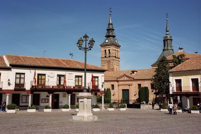
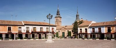
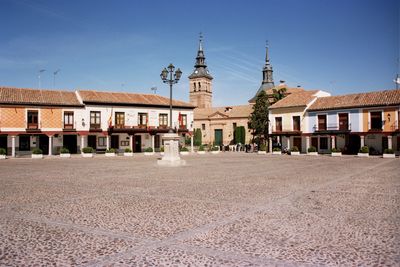
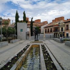
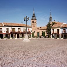
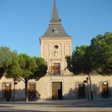
Navalcarnero is a municipality in the Community of Madrid characterized by traditional Castilian buildings with wooden balconies and stone arcades spread across the terrain. The street layout follows the typical pattern of a Spanish small town with a central plaza and narrow streets connecting historic churches and local markets.

The settlement was established in 1499 by Segovia to resolve territorial conflicts and gained independence in 1627. Despite this separation, the municipality retained Segovia's coat of arms, preserving today a symbol of its historical connection to the neighboring city.

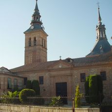
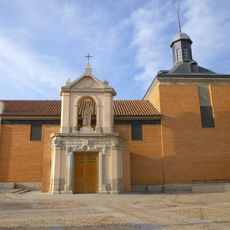
The Parish Church of Nuestra Señora de la Asunción features a bell tower in Mudéjar style and houses religious artworks from the 16th century. These pieces reflect the spiritual importance the place has held for the community over the centuries.

The place can be reached by car via the A-5 freeway or by bus from Madrid's Príncipe Pío station, with travel taking around 45 minutes. It is best to explore the center on foot, as many historic buildings lie close together in narrow streets and are difficult to access by car.

Beneath the town's streets lies a network of underground caves that have been used for generations to produce wine and store food. Today visitors can explore these hidden cellars on guided tours and discover the craft heritage of local wine production.

Location: Community of Madrid

Capital city: Navalcarnero

Elevation above the sea: 670 m

Part of: Mancomunidad del Sur

Shares border with: Villaviciosa de Odón, Móstoles, Arroyomolinos, Moraleja de Enmedio, Batres, El Álamo, Villamanta, Sevilla la Nueva, Casarrubios del Monte

Website: http://ayto-navalcarnero.com

GPS coordinates: 40.28472,-4.01361

Latest update: December 17, 2025 08:06

Photos
Reviews

Visited this place? Tap the stars to rate it and share your experience / photos with the community! Try now! You can cancel it anytime.

« Navalcarnero - Wine region municipality in Community of Madrid, Spain » is provided by Around Us (aroundus.com). Images and texts are derived from Wikimedia project under a Creative Commons license. You are allowed to copy, distribute, and modify copies of this page, under the conditions set by the license, as long as this note is clearly visible.

Discover hidden gems everywhere you go!

From secret cafés to breathtaking viewpoints, skip the crowded tourist spots and find places that match your style. Our app makes it easy with voice search, smart filtering, route optimization, and insider tips from travelers worldwide. Download now for the complete mobile experience.

Around Us App Screenshot

A unique approach to discovering new places

Le Figaro

All the places worth exploring

France Info

A tailor-made excursion in just a few clicks

20 Minutes