Jerez de los Caballeros

Log in to your account

AroundUs is a community-driven map of interesting places, built by curious explorers like you. It grows with every review, story, and photo you share.
Connect to save your favorite spots, contribute locations, and create personalized routes.
Continue with Google
Continue with Apple
Continue with X
Continue with Facebook
Continue with email
By continuing, you accept our Terms and Conditions and our Privacy Policy
Create an account
Add to collection
Map
Suggest a change
Share

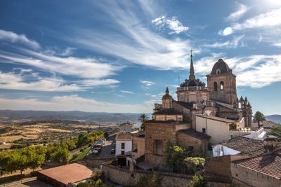
Jerez de los Caballeros, Medieval town in Badajoz province, Spain.

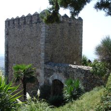
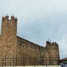
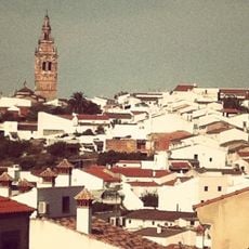
Jerez de los Caballeros is a municipality in Badajoz province that spreads across two hills overlooking a river, surrounded by fortified walls with six gates and stone towers. The town holds several significant religious buildings and other structures that reflect its medieval past.

The Knights Templar received control of the settlement in 1240, leading to major expansion and the construction of numerous religious buildings until their dissolution in 1312. The town's appearance and structure changed significantly after that period.

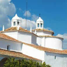
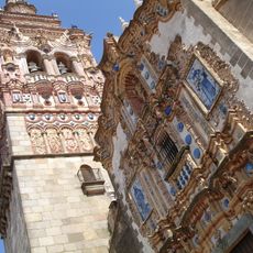
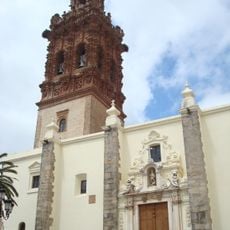
The four main churches—San Bartolome, San Miguel, Santa Catalina, and La Encarnacion—showcase a mix of Gothic, Renaissance, and Baroque styles across their facades and interiors. These buildings shape the town's character and reflect different periods of local artistic tradition.

The town is best explored on foot, since the medieval streets are narrow and spread across the hills, which means comfortable shoes and time for wandering are needed. An annual festival takes place that showcases local products and crafts from the region.

This is the birthplace of Vasco Nunez de Balboa, the first European to see the Pacific Ocean, and the town preserves an old fortress with roots in Arab architecture. The connection between this local figure and his famous discoveries gives the town special historical significance.

Location: Province of Badajoz

Capital city: Jerez de los Caballeros

Elevation above the sea: 506 m

Part of: Mancomunitat Integral Sierra Suroeste

Shares border with: Higuera la Real, Encinasola, Oliva de la Frontera, Zahínos, Higuera de Vargas, Barcarrota, Salvaleón, Salvatierra de los Barros, Burguillos del Cerro, Fregenal de la Sierra

Website: https://jerezcaballeros.es

GPS coordinates: 38.32081,-6.77303

Latest update: December 17, 2025 10:20

Photos
Reviews

Visited this place? Tap the stars to rate it and share your experience / photos with the community! Try now! You can cancel it anytime.

« Jerez de los Caballeros - Medieval town in Badajoz province, Spain » is provided by Around Us (aroundus.com). Images and texts are derived from Wikimedia project under a Creative Commons license. You are allowed to copy, distribute, and modify copies of this page, under the conditions set by the license, as long as this note is clearly visible.

Discover hidden gems everywhere you go!

From secret cafés to breathtaking viewpoints, skip the crowded tourist spots and find places that match your style. Our app makes it easy with voice search, smart filtering, route optimization, and insider tips from travelers worldwide. Download now for the complete mobile experience.

Around Us App Screenshot

A unique approach to discovering new places

Le Figaro

All the places worth exploring

France Info

A tailor-made excursion in just a few clicks

20 Minutes