Lora del Río

Log in to your account

AroundUs is a community-driven map of interesting places, built by curious explorers like you. It grows with every review, story, and photo you share.
Connect to save your favorite spots, contribute locations, and create personalized routes.
Continue with Google
Continue with Apple
Continue with X
Continue with Facebook
Continue with email
By continuing, you accept our Terms and Conditions and our Privacy Policy
Create an account
Add to collection
Map
Suggest a change
Share

Lora del Río, Municipality in the province of Seville, Spain

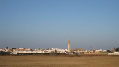
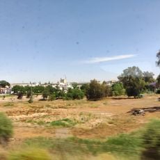
Lora del Río is a municipality in Seville Province situated in the fertile Guadalquivir valley, an area known for its agricultural production. The town sits on flat terrain shaped by river currents and farming, with the landscape spreading across the valley floor.

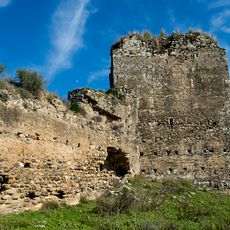
In 1243, King Ferdinand III of Castile took control of the settlement from Moorish rulers and handed it to the Knights of Malta. This transfer marked the beginning of a new period of Christian rule that would shape the area's development for centuries to come.

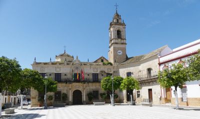
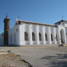
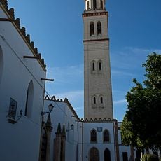
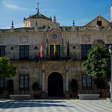
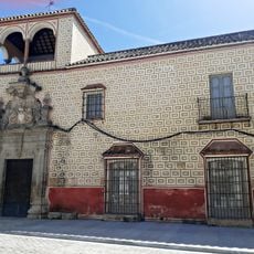
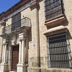
The Priory Church of Our Lady of Setefilla is the main religious building that shows the area's architectural traditions and heritage. Walking through the town, you can see how religion and community life are closely connected in the daily rhythm of the place.

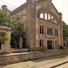
The town sits on the railway line connecting Seville and Córdoba, providing convenient train links for visitors. Its location in the valley makes it easy to explore on foot, and there is plenty of space to walk around the flat landscape.

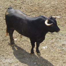
The area is home to specialized breeding grounds for fighting bulls, a practice that continues in dedicated facilities throughout the region. This tradition reflects deep roots in local culture and remains an important part of what the community is known for.

Location: Seville Province

Capital city: Lora del Río

Elevation above the sea: 38 m

Part of: districte notarial de Martos, Mancomunitat de Municipis de la Vega Alta de Sevilla, Mancomunidad de Servicios «La Vega», Vega del Guadalquivir

Shares border with: Alcolea del Río, Villanueva del Río y Minas, Constantina, La Puebla de los Infantes, Peñaflor, Palma del Río, La Campana, Carmona

Website: http://loradelrio.es

GPS coordinates: 37.65722,-5.52667

Latest update: December 20, 2025 12:51

Photos
Reviews

Visited this place? Tap the stars to rate it and share your experience / photos with the community! Try now! You can cancel it anytime.

« Lora del Río - Municipality in the province of Seville, Spain » is provided by Around Us (aroundus.com). Images and texts are derived from Wikimedia project under a Creative Commons license. You are allowed to copy, distribute, and modify copies of this page, under the conditions set by the license, as long as this note is clearly visible.

Discover hidden gems everywhere you go!

From secret cafés to breathtaking viewpoints, skip the crowded tourist spots and find places that match your style. Our app makes it easy with voice search, smart filtering, route optimization, and insider tips from travelers worldwide. Download now for the complete mobile experience.

Around Us App Screenshot

A unique approach to discovering new places

Le Figaro

All the places worth exploring

France Info

A tailor-made excursion in just a few clicks

20 Minutes