Enable Location

We need your location to show you interesting places around you

Discover nearby places

Find interesting locations and hidden gems around you

Precise directions

Get accurate directions and distances to places

Your location is never shared with other users. It's only used when you tap the location button.

Montcabrer

Log in to your account

Start exploring — it's free

Trusted by 62,079 travelers worldwide

Continue with Google
Continue with Apple
or

We will send you a code to connect

By continuing, you accept our Terms and Conditions and our Privacy Policy

Check your inbox

We've sent a pincode in your inbox. Please enter the code below.

Montcabrer

Montcabrer, Mountain summit in Sierra de Mariola, Spain.

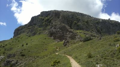
Montcabrer is a mountain summit in the Sierra de Mariola that rises to 1,390 meters elevation and ranks among the highest peaks in Alicante province. The mountain has a distinctive pyramidal shape that offers wide views from the top across the surrounding valleys and ridges.

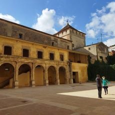
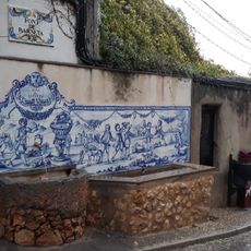
The name comes from shepherds who herded goats across the mountain paths, since 'cabra' means goat in Spanish. Use as grazing land shaped this mountain's character for many centuries.

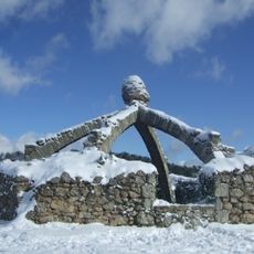
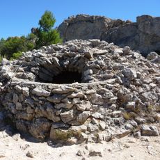
Along the mountain paths you can find old snow wells, structures that local communities once used to store snow and make ice. These buildings show how people adapted to life at this elevation.

The hiking route starts from Muro de Alcoy and follows a network of local trails around the mountain. The cooler months offer the best conditions, as the elevation means strong sun exposure during warmer seasons.

During winter months this peak frequently receives snow cover, creating different hiking conditions from other hills in the region. The snow transforms the landscape and offers completely new perspectives on the familiar route.

The community of curious travelers

AroundUs brings together thousands of curated places, local tips, and hidden gems, enriched daily by 60,000 contributors worldwide.

Start exploring
Location
Elevation above the sea
1,390 m
GPS coordinates
38.75785,-0.48784
Latest update
December 11, 2025 11:08
« Montcabrer - Mountain summit in Sierra de Mariola, Spain » is provided by Around Us (aroundus.com). Images and texts are derived from Wikimedia project under a Creative Commons license. You are allowed to copy, distribute, and modify copies of this page, under the conditions set by the license, as long as this note is clearly visible.

Discover hidden gems everywhere you go!

From secret cafés to breathtaking viewpoints, skip the crowded tourist spots and find places that match your style. Our app makes it easy with voice search, smart filtering, route optimization, and insider tips from travelers worldwide. Download now for the complete mobile experience.

Around Us App Screenshot

A unique approach to discovering new places

Le Figaro

All the places worth exploring

France Info

A tailor-made excursion in just a few clicks

20 Minutes

Around Us
Travel Guide & Maps
Download

Send to your phone

QR Code
1

Open the camera app on your mobile.

2

Point at the QR code with your camera. A notification will appear.

3

Tap the notification to open the link.