Laguiole, Rural commune in Aveyron, France
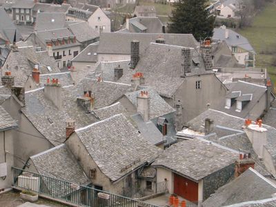
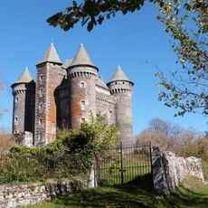
Laguiole is a rural commune spread across the Aubrac plateau in central France, sitting at elevations between 870 and 1,340 meters (2,850 and 4,400 feet). The landscape consists of volcanic terrain with open spaces and scattered settlements typical of mountain regions.
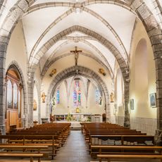
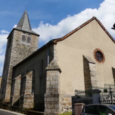
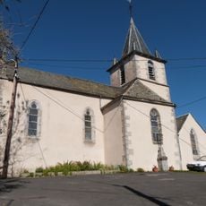
The name comes from the Occitan word "la gleisòla," meaning a small church that marked where settlement began in this mountain area. This religious landmark helped establish the community and draw people to this remote location.
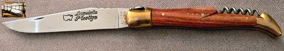
Knife crafting remains deeply rooted in daily life here, with artisans working openly in their workshops where locals and visitors can watch the process. The tradition shapes how people view their work and their connection to this mountain community.
You can watch craftspeople at work in local forges, where traditional knife-making is demonstrated throughout the day. The location sits high in the mountains, so bring layers and prepare for cooler temperatures regardless of the season.
The local forge once received iron from the Eiffel Tower to create a special knife collection celebrating its 120th anniversary. This unusual connection between a small mountain village and France's most famous monument reflects the recognition of the community's craftsmanship.
Location: canton of Laguiole
Location: Aveyron
Location: διακοινοτική κοινότητα Ωμπράκ-Λαγιόλ
Location: arrondissement of Rodez
Elevation above the sea: 1,091 m
Shares border with: Argences en Aubrac, Cassuéjouls, Curières, La Trinitat, Montpeyroux, Soulages-Bonneval, Saint-Urcize
Address: 12210 Laguiole, France
Phone: +33565512630
Email: mairie@laguiole12.fr
Website: http://laguiole12.fr
GPS coordinates: 44.68417,2.84722
Latest update: December 19, 2025 22:49
Château du Bousquet, Laguiole
4.4 km
Château de la Boissonnade
2.1 km
Château d'Oustrac
857 m
Église Saint-Matthieu de Laguiole
212 m
Presbytère de Laguiole
150 m
Église de Cassuéjouls
5.3 kmVergne Noire (De La)
6.3 km
Église Saint-André du Bousquet
4.3 kmChemin de Compostelle, entre Nasbinals et Saint-Chély-d'Aubrac
6.3 km
Chapelle Sainte-Thérèse de Laguiole
69 mToposcope, scenic viewpoint
225 mLa Gentiane Pneumonanthe
328 mCroix du Fort
209 mVierge du Fort
239 mVierge
2.3 kmWork of art, sculpture
725 mWork of art, statue
6.4 kmCroix du Fort
264 mTaureau de Laguiole
133 mCroix du Rouquet
308 mWayside cross
411 mWayside cross
392 mWayside cross, boulder
888 mWayside cross
3.1 kmWayside cross
1.2 kmCroix de Megevie
2.5 kmWayside cross
5.7 kmVisited this place? Tap the stars to rate it and share your experience / photos with the community! Try now! You can cancel it anytime.
Discover hidden gems everywhere you go!
From secret cafés to breathtaking viewpoints, skip the crowded tourist spots and find places that match your style. Our app makes it easy with voice search, smart filtering, route optimization, and insider tips from travelers worldwide. Download now for the complete mobile experience.
A unique approach to discovering new places❞
— Le Figaro
All the places worth exploring❞
— France Info
A tailor-made excursion in just a few clicks❞
— 20 Minutes