Enable Location

We need your location to show you interesting places around you

Discover nearby places

Find interesting locations and hidden gems around you

Precise directions

Get accurate directions and distances to places

Your location is never shared with other users. It's only used when you tap the location button.

Log in to your account

Start exploring — it's free

Trusted by 62,125 travelers worldwide

Continue with Google
Continue with Apple
or

We will send you a code to connect

By continuing, you accept our Terms and Conditions and our Privacy Policy

Check your inbox

We've sent a pincode in your inbox. Please enter the code below.

Nagaur district, Administrative district in Rajasthan, India

Nagaur district is an administrative region in western Rajasthan that extends across arid landscapes and farmland, particularly near the Luni River. The area contains several historical sites and towns connected by a network of roads and rail lines.

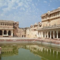
Nagaur Fort was built in the early 12th century as one of northern India's first Muslim fortifications and was later modified by various ruling dynasties. The district later developed as an administrative region during British rule in the area.

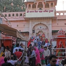
The region preserves traditional Rajasthani music performances that remain part of community life, and local festivals reflect the spiritual beliefs of the people living here. These customs shape how villagers gather and celebrate together throughout the year.

Visitors reach the district by highways and railways that connect larger cities with the main town of Nagaur. The cooler months offer the best time to visit, as the region gets very hot and dry during summer.

Khimsar Fort is an approximately 500-year-old structure now operating as a guesthouse where visitors can stay within historical walls. This restored fortress offers a rare glimpse of life in a former stronghold set in desert landscape.

The community of curious travelers

AroundUs brings together thousands of curated places, local tips, and hidden gems, enriched daily by 60,000 contributors worldwide.

Start exploring
Location
Capital city
Nagaur
Shares border with
Bikaner district, Pali district, Ajmer district
GPS coordinates
27.20000,73.73333
Latest update
December 20, 2025 13:01
« Nagaur district - Administrative district in Rajasthan, India » is provided by Around Us (aroundus.com). Images and texts are derived from Wikimedia project under a Creative Commons license. You are allowed to copy, distribute, and modify copies of this page, under the conditions set by the license, as long as this note is clearly visible.

Discover hidden gems everywhere you go!

From secret cafés to breathtaking viewpoints, skip the crowded tourist spots and find places that match your style. Our app makes it easy with voice search, smart filtering, route optimization, and insider tips from travelers worldwide. Download now for the complete mobile experience.

Around Us App Screenshot

A unique approach to discovering new places

Le Figaro

All the places worth exploring

France Info

A tailor-made excursion in just a few clicks

20 Minutes

Around Us
Travel Guide & Maps
Download

Send to your phone

QR Code
1

Open the camera app on your mobile.

2

Point at the QR code with your camera. A notification will appear.

3

Tap the notification to open the link.