Segni

Log in to your account

AroundUs is a community-driven map of interesting places, built by curious explorers like you. It grows with every review, story, and photo you share.
Connect to save your favorite spots, contribute locations, and create personalized routes.
Continue with Google
Continue with Apple
Continue with X
Continue with Facebook
Continue with email
By continuing, you accept our Terms and Conditions and our Privacy Policy
Create an account
Add to collection
Map
Suggest a change
Share

Segni, Administrative commune in Metropolitan City of Rome, Italy

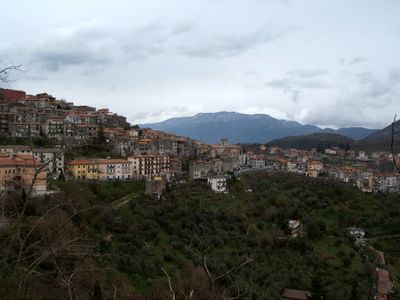
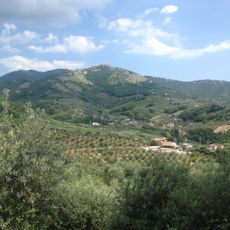
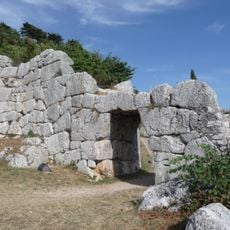
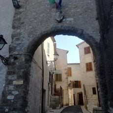
Segni is a municipality in the Lepini Mountains within the Metropolitan City of Rome, positioned on a hilltop at about 668 meters in elevation. The settlement overlooks the Sacco River valley and features ancient fortification walls made of polygonal stone with multiple defensive gates.

The settlement began as a Roman colony established under King Lucius Tarquinius Superbus during the early development of Rome's territorial power. The sophisticated polygonal stone walls demonstrate Roman engineering methods from that ancient period.

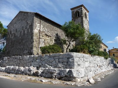
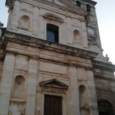
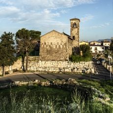
The Co-cathedral of Santa Maria Assunta anchors the town center, blending Romanesque and Baroque styles across its structure and creating a visual timeline of different building periods. Walking through the church reveals how successive generations added to and rebuilt the space over centuries.

The town connects to Rome by regional roads and public transit, making it accessible from the city center. The hilltop location requires walking to explore the old fortifications and central areas, so comfortable footwear is recommended.

British archaeologists continue active excavations at the ancient acropolis, regularly discovering artifacts that reveal details about Roman life and practices at the site. These ongoing investigations suggest substantial remains still lie beneath the surface waiting to be found.

Location: Metropolitan City of Rome

Capital city: Segni

Elevation above the sea: 668 m

Shares border with: Artena, Colleferro, Cori, Gavignano, Montelanico, Paliano, Rocca Massima, Anagni

Website: http://comune.segni.rm.it

GPS coordinates: 41.68333,13.01667

Latest update: December 20, 2025 13:49

Photos
Reviews

Visited this place? Tap the stars to rate it and share your experience / photos with the community! Try now! You can cancel it anytime.

« Segni - Administrative commune in Metropolitan City of Rome, Italy » is provided by Around Us (aroundus.com). Images and texts are derived from Wikimedia project under a Creative Commons license. You are allowed to copy, distribute, and modify copies of this page, under the conditions set by the license, as long as this note is clearly visible.

Discover hidden gems everywhere you go!

From secret cafés to breathtaking viewpoints, skip the crowded tourist spots and find places that match your style. Our app makes it easy with voice search, smart filtering, route optimization, and insider tips from travelers worldwide. Download now for the complete mobile experience.

Around Us App Screenshot

A unique approach to discovering new places

Le Figaro

All the places worth exploring

France Info

A tailor-made excursion in just a few clicks

20 Minutes