Enable Location

We need your location to show you interesting places around you

Discover nearby places

Find interesting locations and hidden gems around you

Precise directions

Get accurate directions and distances to places

Your location is never shared with other users. It's only used when you tap the location button.

Tschenglser Hochwand

Log in to your account

Start exploring — it's free

Trusted by 60,653 travelers worldwide

Continue with Google
Continue with Apple
or

We will send you a code to connect

By continuing, you accept our Terms and Conditions and our Privacy Policy

Check your inbox

We've sent a pincode in your inbox. Please enter the code below.

Tschenglser Hochwand

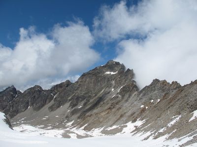
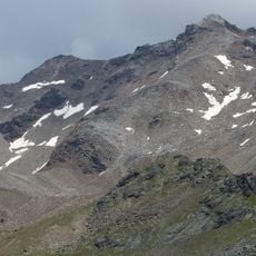
Tschenglser Hochwand, Mountain summit in South Tyrol, Italy.

Description

Croda di Cengels, also called Tschenglser Hochwand, is a mountain summit at 3375 meters elevation that sits where three valleys meet: Cengles Valley, Zai Valley, and Razoi Valley in the Ortles Alps. The peak has steep rock faces and sharp ridges with multiple climbing routes at different difficulty levels.

History

The first recorded ascent of this peak was in 1871 when climber V. Hecht and guide J. Pingerra reached the summit via the southwest ridge. In more recent times, new routes have been added to the mountain, including a via ferrata path opened in 2002.

Culture

The mountain sits within Stelvio National Park, where German and Italian cultural traditions overlap and shape the alpine heritage of this border region. From the summit on clear days, you can see valleys on both sides, reflecting how climbers here belong to two different worlds.

Practical

The climb starts from Rifugio Serristori at 2721 meters elevation and follows marked path number 5 to Passo di Zai before ascending through a steep gully to reach the ridge. Start early and bring proper rock climbing gear and clothing for changing weather conditions at altitude.

Did you know?

The mountain offers climbers three different routes to choose from, including a normal path and two via ferratas with varying demands. The newest of these routes was established in 2002, making it quite recent compared to the peak's long climbing history.

GPS coordinates
46.56430,10.62913
Latest update
December 14, 2025 18:05

AroundUs brings together thousands of curated places, local tips, and hidden gems, enriched daily by 60,000 contributors worldwide. Discover all places nearby (Italy).

« Tschenglser Hochwand - Mountain summit in South Tyrol, Italy » is provided by Around Us (aroundus.com). Images and texts are derived from Wikimedia project under a Creative Commons license. You are allowed to copy, distribute, and modify copies of this page, under the conditions set by the license, as long as this note is clearly visible.

Discover hidden gems everywhere you go!

From secret cafés to breathtaking viewpoints, skip the crowded tourist spots and find places that match your style. Our app makes it easy with voice search, smart filtering, route optimization, and insider tips from travelers worldwide. Download now for the complete mobile experience.

Around Us App Screenshot

A unique approach to discovering new places

Le Figaro

All the places worth exploring

France Info

A tailor-made excursion in just a few clicks

20 Minutes

Around Us
Travel Guide & Maps
Download

Send to your phone

QR Code
1

Open the camera app on your mobile.

2

Point at the QR code with your camera. A notification will appear.

3

Tap the notification to open the link.