Enable Location

We need your location to show you interesting places around you

Discover nearby places

Find interesting locations and hidden gems around you

Precise directions

Get accurate directions and distances to places

Your location is never shared with other users. It's only used when you tap the location button.

Wilhelminaoord

Log in to your account

Start exploring — it's free

Trusted by 61,909 travelers worldwide

Continue with Google
Continue with Apple
or

We will send you a code to connect

By continuing, you accept our Terms and Conditions and our Privacy Policy

Check your inbox

We've sent a pincode in your inbox. Please enter the code below.

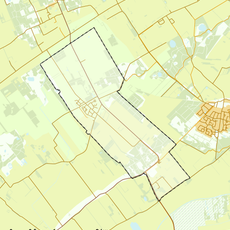
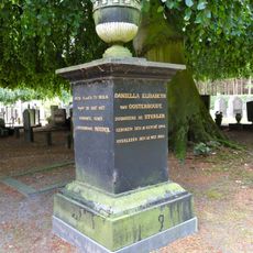
Wilhelminaoord, Heritage colony site in Westerveld, Netherlands.

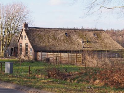
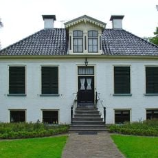
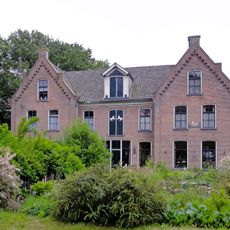
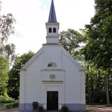
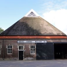
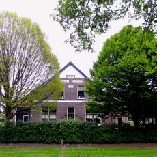
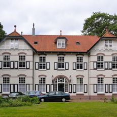
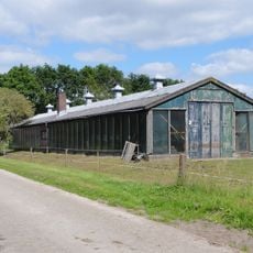
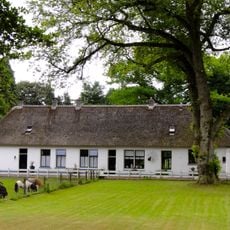
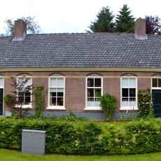
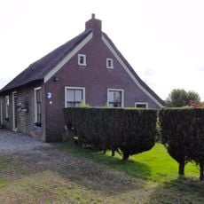
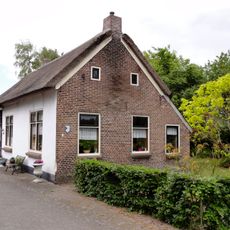
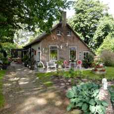
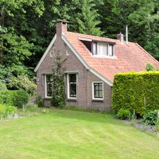
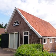
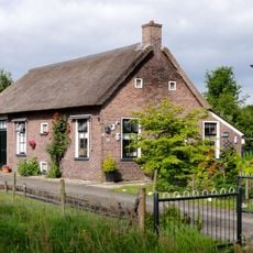
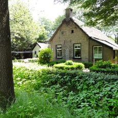
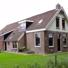
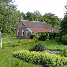
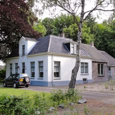
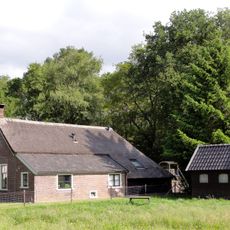
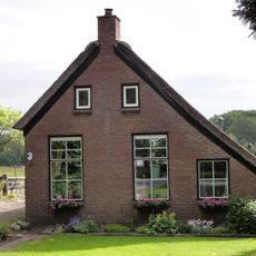
Wilhelminaoord is a planned settlement from the 19th century on the Westerveld countryside with neatly arranged residences, worker dormitories, and a central church building. The layout follows a systematic design where everything was arranged for communal living and work.

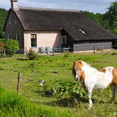
The settlement was founded around 1820 to provide impoverished people with work, housing, and training so they could become self-sufficient. It became part of a larger Dutch program to support disadvantaged citizens.

The settlement shows how communities were meant to live together in the past: residents worked the fields and learned trades within an environment designed to support their livelihoods. The layout of buildings and pathways reflects this vision, illustrating how work, education, and housing were organized as one system.

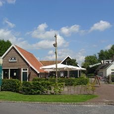
The settlement sits in the countryside and is reachable by regional bus from Steenwijk station. A visitor center in nearby Frederiksoord offers information and guided tours of the grounds.

The colony pioneered an early social security system where residents received financial protection, which influenced modern Dutch welfare programs. This experiment was quite advanced for its time and demonstrated new approaches to fighting poverty.

The community of curious travelers

AroundUs brings together thousands of curated places, local tips, and hidden gems, enriched daily by 60,000 contributors worldwide.

Start exploring
Location
GPS coordinates
52.85610,6.16390
Latest update
December 10, 2025 15:49
Around this place
Huis Westerbeek
Netherlands

Huis Westerbeek

1.7 km
Museum De Koloniehof
Netherlands

Museum De Koloniehof

2 km
Westerbeeksloot
Netherlands

Westerbeeksloot

1.7 km
Koningin Wilhelminalaan 20, Wilhelminaoord
Netherlands

Koningin Wilhelminalaan 20, Wilhelminaoord

801 m
Hervormde Kerk
Netherlands

Hervormde Kerk

252 m
Hoeve Koning Willem III
Netherlands

Hoeve Koning Willem III

855 m
Hoeve Prinses Marianne
Netherlands

Hoeve Prinses Marianne

1.1 km
Rustoord II
Netherlands

Rustoord II

649 m
Kiemhuis
Netherlands

Kiemhuis

824 m
Wilhelminaoord school
Netherlands

Wilhelminaoord school

700 m
Rustoord I
Netherlands

Rustoord I

537 m
Rijksbeschermd gezicht Frederiksoord-Wilhelminaoord
Netherlands

Rijksbeschermd gezicht Frederiksoord-Wilhelminaoord

484 m
Grafmonument Daniella Elisabeth van Oosterhoudt
Netherlands

Grafmonument Daniella Elisabeth van Oosterhoudt

748 m
Koloniewoning van de Maatschappij van Weldadigheid
Netherlands

Koloniewoning van de Maatschappij van Weldadigheid

1 km
Koloniewoning van de Maatschappij van Weldadigheid
Netherlands

Koloniewoning van de Maatschappij van Weldadigheid

1.3 km
Koloniewoning van de Maatschappij van Weldadigheid
Netherlands

Koloniewoning van de Maatschappij van Weldadigheid

977 m
Koloniewoning van de Maatschappij van Weldadigheid
Netherlands

Koloniewoning van de Maatschappij van Weldadigheid

1.9 km
Koningin Wilhelminalaan 87, Frederiksoord
Netherlands

Koningin Wilhelminalaan 87, Frederiksoord

2 km
Koloniewoning van de Maatschappij van Weldadigheid
Netherlands

Koloniewoning van de Maatschappij van Weldadigheid

400 m
M.A. van Naamen van Eemneslaan 62, Wilhelminaoord
Netherlands

M.A. van Naamen van Eemneslaan 62, Wilhelminaoord

153 m
Koloniewoning van de Maatschappij van Weldadigheid
Netherlands

Koloniewoning van de Maatschappij van Weldadigheid

1.6 km
Joods monument
Netherlands

Joods monument

2.8 km
Koloniewoning van de Maatschappij van Weldadigheid
Netherlands

Koloniewoning van de Maatschappij van Weldadigheid

1.4 km
Koloniewoning van de Maatschappij van Weldadigheid
Netherlands

Koloniewoning van de Maatschappij van Weldadigheid

434 m
Voorm. hervormde pastorie
Netherlands

Voorm. hervormde pastorie

261 m
Koloniewoning van de Maatschappij van Weldadigheid
Netherlands

Koloniewoning van de Maatschappij van Weldadigheid

350 m
Koloniewoning van de Maatschappij van Weldadigheid
Netherlands

Koloniewoning van de Maatschappij van Weldadigheid

277 m
Hoeve Prinses Marianne, hooischuur
Netherlands

Hoeve Prinses Marianne, hooischuur

1.1 km
Show the full map
« Wilhelminaoord - Heritage colony site in Westerveld, Netherlands » is provided by Around Us (aroundus.com). Images and texts are derived from Wikimedia project under a Creative Commons license. You are allowed to copy, distribute, and modify copies of this page, under the conditions set by the license, as long as this note is clearly visible.

Discover hidden gems everywhere you go!

From secret cafés to breathtaking viewpoints, skip the crowded tourist spots and find places that match your style. Our app makes it easy with voice search, smart filtering, route optimization, and insider tips from travelers worldwide. Download now for the complete mobile experience.

Around Us App Screenshot

A unique approach to discovering new places

Le Figaro

All the places worth exploring

France Info

A tailor-made excursion in just a few clicks

20 Minutes

Around Us
Travel Guide & Maps
Download

Send to your phone

QR Code
1

Open the camera app on your mobile.

2

Point at the QR code with your camera. A notification will appear.

3

Tap the notification to open the link.