Log in to your account

AroundUs is a community-driven map of interesting places, built by curious explorers like you. It grows with every review, story, and photo you share.
Connect to save your favorite spots, contribute locations, and create personalized routes.
Continue with Google
Continue with Apple
Continue with X
Continue with Facebook
Continue with email
By continuing, you accept our Terms and Conditions and our Privacy Policy
Create an account
Add to collection
Map
Suggest a change
Share

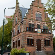
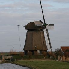
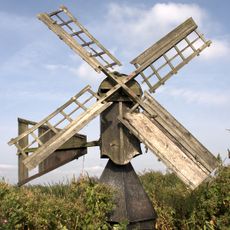
Eilandspolder, Protected wetland polder in Noord-Holland, Netherlands.

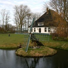
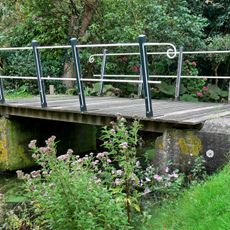
Eilandspolder is a wetland polder of about 1,400 hectares in Noord-Holland comprising grasslands, natural lakes, and marsh vegetation. The area supports diverse bird populations and small mammals across its landscape of water and grassland.

Until the 10th century, the area formed part of a connected peat landscape before major storms in the 12th and 13th centuries reshaped it dramatically. These flood events created the water bodies and molded the polder landscape we see today.

The eastern section shows long, regularly arranged field parcels shaped by generations of farming. These patterns reflect traditional land management practices that still define how the landscape looks today.

The area maintains strict environmental protection under Natura 2000 and the Birds Directive, so visitors must stick to designated paths. Early morning and evening visits are best for observing wildlife without disturbing the resident birds.

The water contains specific salt concentrations between 150 and 350 milligrams per liter, supporting specialized aquatic plants and animals. This slightly elevated salinity creates a unique environment that only certain species can inhabit.

Location: Hoogheemraadschap Hollands Noorderkwartier

Inception: 2000

Part of: Natuurnetwerk Nederland

GPS coordinates: 52.56920,4.81580

Latest update: December 18, 2025 11:40

Photos
Around this place
Town hall of Graft
Netherlands

Town hall of Graft

1.3 km
Sint-Bonifatiuskerk
Netherlands

Sint-Bonifatiuskerk

2.3 km
Poldermolen K
Netherlands

Poldermolen K

2.4 km
Doopsgezinde vermaning, Noordeinde
Netherlands

Doopsgezinde vermaning, Noordeinde

1.4 km
Weidemolen Grootschermer
Netherlands

Weidemolen Grootschermer

1.8 km
Tjasker Zuidschermer
Netherlands

Tjasker Zuidschermer

2.3 km
Graftdijkplein 3, West-Graftdijk
Netherlands

Graftdijkplein 3, West-Graftdijk

2.1 km
Fundamenten en zerkenvloer van de Hervormde Kerk
Netherlands

Fundamenten en zerkenvloer van de Hervormde Kerk

1.3 km
De waterput is opgebouwd uit baksteen, voorzien van een hardstenen afdekplaat met geperforeerde ijzeren deksel.
Netherlands

De waterput is opgebouwd uit baksteen, voorzien van een hardstenen afdekplaat met geperforeerde ijzeren deksel.

1.4 km
De brug over de wegsloot bestaat uit twee betonnen landhoofden die over de sloot met elkaar zijn verbonden door een samenstelsel van houten planken.
Netherlands

De brug over de wegsloot bestaat uit twee betonnen landhoofden die over de sloot met elkaar zijn verbonden door een samenstelsel van houten planken.

1.4 km
Driehuizen 11, Driehuizen
Netherlands

Driehuizen 11, Driehuizen

1.2 km
Kerkstraat 28, De Rijp
Netherlands

Kerkstraat 28, De Rijp

2.4 km
Kerkstraat 24, De Rijp
Netherlands

Kerkstraat 24, De Rijp

2.4 km
Voormalige pastorie, thans woonhuis
Netherlands

Voormalige pastorie, thans woonhuis

1.3 km
Voormalig weeshuis van de nederlands hervormde gemeente
Netherlands

Voormalig weeshuis van de nederlands hervormde gemeente

1.6 km
Brug die de verbinding vormt tussen het perceel waarop de vermaning en kosterswoning zijn gelegen en de evenwijdig aan de sloot lopende weg.
Netherlands

Brug die de verbinding vormt tussen het perceel waarop de vermaning en kosterswoning zijn gelegen en de evenwijdig aan de sloot lopende weg.

1.4 km
Noordeinde 16, Noordeinde
Netherlands

Noordeinde 16, Noordeinde

1.4 km
Langebrugspad 4, De Rijp
Netherlands

Langebrugspad 4, De Rijp

2.3 km
Kerkstraat 26, De Rijp
Netherlands

Kerkstraat 26, De Rijp

2.4 km
Driehuizen 13, Driehuizen
Netherlands

Driehuizen 13, Driehuizen

1.1 km
Schuur gebouwd ten zuidoosten van de voormalige pastorie van de Doopsgezinde Vermaning
Netherlands

Schuur gebouwd ten zuidoosten van de voormalige pastorie van de Doopsgezinde Vermaning

1.4 km
Rechthoekig pand onder pannen zadeldak tussen puntgevels
Netherlands

Rechthoekig pand onder pannen zadeldak tussen puntgevels

2.4 km
Kosterwoning van de Doopsgezinde Gemeente te Graft-Noordeinde
Netherlands

Kosterwoning van de Doopsgezinde Gemeente te Graft-Noordeinde

1.4 km
Pastorie
Netherlands

Pastorie

2.3 km
Rechtestraat 142, De Rijp
Netherlands

Rechtestraat 142, De Rijp

2.4 km
Transformatorgebouw, Graft
Netherlands

Transformatorgebouw, Graft

1.4 km
Vlaander 8, De Rijp
Netherlands

Vlaander 8, De Rijp

2.4 km
Venbuurt 7, De Rijp
Netherlands

Venbuurt 7, De Rijp

2.4 km
Show the full map
Reviews

Visited this place? Tap the stars to rate it and share your experience / photos with the community! Try now! You can cancel it anytime.

« Eilandspolder - Protected wetland polder in Noord-Holland, Netherlands » is provided by Around Us (aroundus.com). Images and texts are derived from Wikimedia project under a Creative Commons license. You are allowed to copy, distribute, and modify copies of this page, under the conditions set by the license, as long as this note is clearly visible.

Discover hidden gems everywhere you go!

From secret cafés to breathtaking viewpoints, skip the crowded tourist spots and find places that match your style. Our app makes it easy with voice search, smart filtering, route optimization, and insider tips from travelers worldwide. Download now for the complete mobile experience.

Around Us App Screenshot

A unique approach to discovering new places

Le Figaro

All the places worth exploring

France Info

A tailor-made excursion in just a few clicks

20 Minutes