
Inundatiesluis onder het raadhuis, Rijksmonument op Hoogstraat 53
Location: Molenlanden
Part of: Vestingwerken Nieuwpoort
Address: Hoogstraat 53
GPS coordinates: 51.93520,4.86861
Latest update: March 24, 2025 16:02
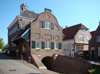

Stadhuis, Nieuwpoort
5 m
Nederlandse Hervormde Kerk, Nieuwpoort
87 m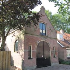
Pieterkerkje
112 m
Buitenhaven 6, Nieuwpoort
46 m
Binnenhaven 16, Nieuwpoort
52 m
Hoogstraat 44, Nieuwpoort
26 m
Binnenhaven 29, Nieuwpoort
127 m
Hoogstraat 58, Nieuwpoort
74 m
Binnenhaven 5, Nieuwpoort
30 m
Binnenhaven 24, Nieuwpoort
95 m
Binnenhaven 30, Nieuwpoort
127 m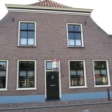
Binnenhaven 38, Nieuwpoort
162 m
Buitenhaven 1, Nieuwpoort
30 m
Hoogstraat 20, Nieuwpoort
97 m
Buitenhaven 5, Nieuwpoort
66 m
Hoogstraat 79, Nieuwpoort
150 m
Hoogstraat 33, Nieuwpoort
71 m
Binnenhaven 33, Nieuwpoort
154 m
Buitenhaven 10, Nieuwpoort
61 m
Buitenhaven 14, Nieuwpoort
73 m
Buitenhaven 13, Nieuwpoort
105 m
Hoogstraat 45, Nieuwpoort
30 m
Buitenhaven 9, Nieuwpoort
81 m
Buitenhaven 3, Nieuwpoort
39 m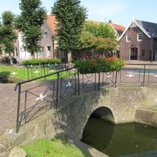
Brug tegenover Kerk
75 m
Binnenhaven 23, Nieuwpoort
100 m
Binnenhaven 17, Nieuwpoort
58 m
Arsenaal
95 mVisited this place? Tap the stars to rate it and share your experience / photos with the community! Try now! You can cancel it anytime.
Discover hidden gems everywhere you go!
From secret cafés to breathtaking viewpoints, skip the crowded tourist spots and find places that match your style. Our app makes it easy with voice search, smart filtering, route optimization, and insider tips from travelers worldwide. Download now for the complete mobile experience.

A unique approach to discovering new places❞
— Le Figaro
All the places worth exploring❞
— France Info
A tailor-made excursion in just a few clicks❞
— 20 Minutes