
Hetland
Location: Bjerkreim Municipality
GPS coordinates: 58.54586,5.94883
Latest update: November 1, 2025 08:47
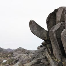
Trollpikken
11.4 km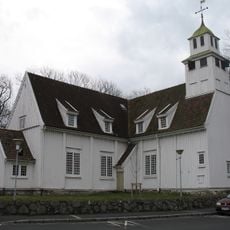
Egersund Church
10.9 km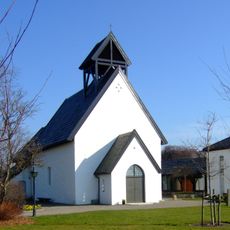
Ogna Church
8.8 km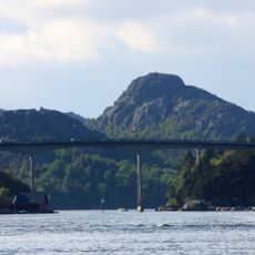
Eigerøy bru
9.6 km
Helleland Municipality
10.1 km
Skrivergården (Egersund)
11 km
Eigerøy Church
11 km
Dalane folkemuseum
9.2 km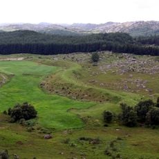
St. Olavsormen
3.2 km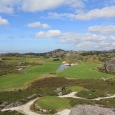
Egersund golfklubb
6.5 km
Ogna
8.9 km
Thoresens hus
11 km
Husabø skole
11.4 km
Vedafjell
10.2 km
Scenic viewpoint
3.2 km
Bunker
11.3 km
The Singing Rock
9.9 km
Helgåleiren
9 km
Losen
10.8 km
Work of art, sculpture
11 km
Steinkjerringa
11.2 km
Fløyen
10.7 km
Kontraritoppen
10.4 km
Scenic viewpoint
11.3 km
Scenic viewpoint
11.3 km
Scenic viewpoint
10.7 km
Scenic viewpoint
8.3 km
Scenic viewpoint
7 kmReviews
Visited this place? Tap the stars to rate it and share your experience / photos with the community! Try now! You can cancel it anytime.
Discover hidden gems everywhere you go!
From secret cafés to breathtaking viewpoints, skip the crowded tourist spots and find places that match your style. Our app makes it easy with voice search, smart filtering, route optimization, and insider tips from travelers worldwide. Download now for the complete mobile experience.

A unique approach to discovering new places❞
— Le Figaro
All the places worth exploring❞
— France Info
A tailor-made excursion in just a few clicks❞
— 20 Minutes