Chest opened
+${chestReward.xp} XP
Explorer
NOUVEAU ×${chestReward.collectible.quantity}
tapez pour fermer
Chest locked

Open chests in the app

Around Us is built for your phone — chests unlock when you walk, explore and capture nearby places.

Enable Location

We need your location to show you interesting places around you

Discover nearby places

Find interesting locations and hidden gems around you

Precise directions

Get accurate directions and distances to places

Your location is never shared with other users. It's only used when you tap the location button.

Sieciechów, Masovian Voivodeship

Log in to your account

Start exploring — it's free

Trusted by 73,051 travelers worldwide

Continue with Google
Continue with Apple
or

We will send you a code to connect

By continuing, you accept our Terms and Conditions and our Privacy Policy

Check your inbox

We've sent a pincode in your inbox. Please enter the code below.

Sieciechów, Masovian Voivodeship
Discussion Reviews 1 Photos
6.9k Popularity

Sieciechów, Masovian Voivodeship, Medieval village in east-central Poland

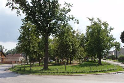
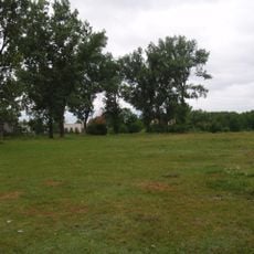
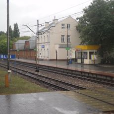
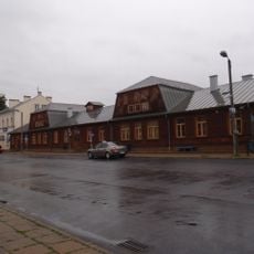
Sieciechów is a village in east-central Poland that spreads along National Road 48 and runs parallel to a railway line connecting Radom and Dęblin. The settlement sits within agricultural fields and countryside, shaped by its rural setting and transportation corridors.

The settlement served as a major administrative center for the Duchy of Sandomierz in medieval times and received town status in 1232. It retained this formal status until 1869, when it reverted to village status due to historical and political changes.

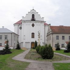
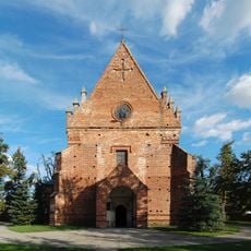
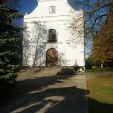
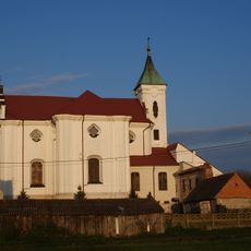
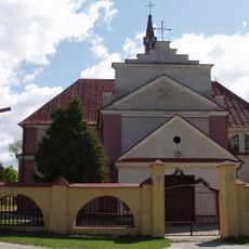
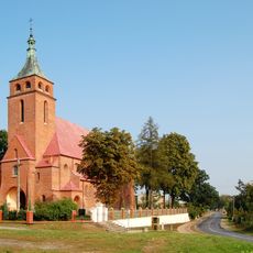
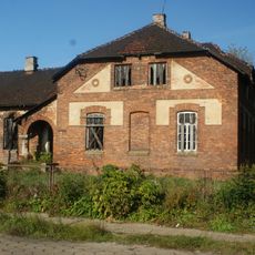
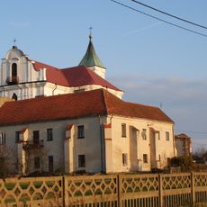
A Baroque abbey church built between 1739 and 1767 stands alongside the St Lawrence parish church from the early 18th century, both shaping the spiritual life of the village. These two structures show how religious architecture became central to how people organized their community and marked important moments in daily life.

The village sits roughly 13 kilometers southeast of Kozienice and about 92 kilometers southeast of Warsaw, with good access via the main road and railway. The location on established transportation routes makes reaching the village straightforward for visitors coming from nearby towns or the capital.

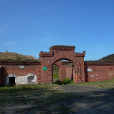
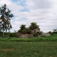
An early medieval castle mentioned by chronicler Gall Anonim was recorded as the strongest fortress along the Vistula River between Sandomierz and Płock. This fortress represented one of the most strategically important defensive structures in the region during its time.

The community of curious travelers

AroundUs brings together thousands of curated places, local tips, and hidden gems, enriched daily by 60,000 contributors worldwide.

Start exploring
GPS coordinates
51.53944,21.74472
Latest update
December 10, 2025 15:49
Reviews
Share your experience

No review yet

Discussions
Start a discussion...

No discussion yet

« Sieciechów, Masovian Voivodeship - Medieval village in east-central Poland » is provided by Around Us (aroundus.com). Images and texts are derived from Wikimedia project under a Creative Commons license. You are allowed to copy, distribute, and modify copies of this page, under the conditions set by the license, as long as this note is clearly visible.

Discover hidden gems everywhere you go!

From secret cafés to breathtaking viewpoints, skip the crowded tourist spots and find places that match your style. Our app makes it easy with voice search, smart filtering, route optimization, and insider tips from travelers worldwide. Download now for the complete mobile experience.

Around Us App Screenshot

A unique approach to discovering new places

Le Figaro

All the places worth exploring

France Info

A tailor-made excursion in just a few clicks

20 Minutes

Around Us
Travel Guide & Maps
Download

Send to your phone

QR Code
1

Open the camera app on your mobile.

2

Point at the QR code with your camera. A notification will appear.

3

Tap the notification to open the link.