Ogrodzenie z bramkami, nationaal monument in Dobra, Polen
Location: Dobra, Lesser Poland Voivodeship
GPS coordinates: 49.71440,20.24442
Latest update: January 19, 2024 21:34

Ćwilin
4.8 km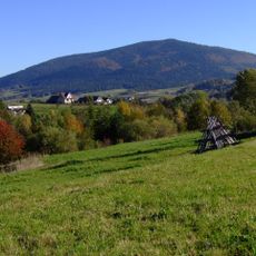
Łopień
2.8 km
Jaskinia Zbójecka
3 km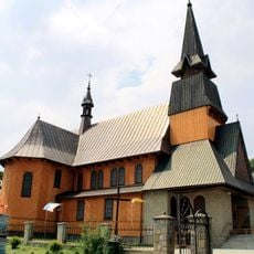
Our Lady of Perpetual Help church in Jurków
3.7 km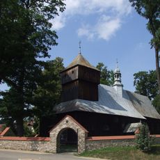
Saints Simon and Jude church in Dobra
22 m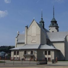
Our Lady of the Scapular church in Dobra
115 m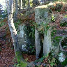
Nature reserve Śnieżnica
3.9 km
Świerczek (Słopnice)
5.7 km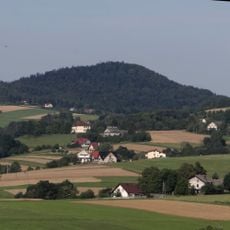
Świnna
5.5 km
Złotopieńska Dziura
1.9 km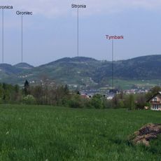
Groniec
5.4 km
Łopień Środkowy
3.3 km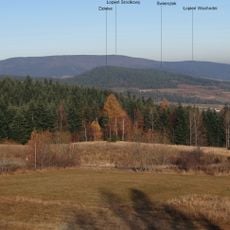
Łopień Wschodni
4.6 km
Stronica (Beskid Wyspowy)
5.1 km
Kościół Miłosierdzia Bożego w Podłopieniu
4.1 km
Wierzki
5.2 km
Muzeum Parafialne w Dobrej
497 m
TSR Góra Podłopień
4.4 km
Mały Ćwilinek
5.6 km
Work of art, sculpture
3.7 km
Scenic viewpoint
4.7 km
Zapora Przeciwrumowiskowa
4.9 km
Scenic viewpoint
4.7 km
Scenic viewpoint
4 km
Scenic viewpoint
3.9 km
Scenic viewpoint
3.8 km
Scenic viewpoint
5.6 km
Work of art, sculpture
3.7 kmReviews
Visited this place? Tap the stars to rate it and share your experience / photos with the community! Try now! You can cancel it anytime.
Discover hidden gems everywhere you go!
From secret cafés to breathtaking viewpoints, skip the crowded tourist spots and find places that match your style. Our app makes it easy with voice search, smart filtering, route optimization, and insider tips from travelers worldwide. Download now for the complete mobile experience.

A unique approach to discovering new places❞
— Le Figaro
All the places worth exploring❞
— France Info
A tailor-made excursion in just a few clicks❞
— 20 Minutes