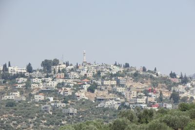
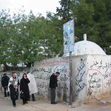
Kefl Hares, village council in Salfit Governorate
Location: Salfit Governorate
Elevation above the sea: 494 m
Shares border with: Salfit
GPS coordinates: 32.11862,35.15695
Latest update: April 5, 2025 03:10
Tomb of Joshua
28 m
Haris Pools
4.4 km
Kamin Hasif
9.2 km
Library of Salfit Municipality
4.5 km
Al Funduq
8.2 km
The Holocaust memorial
2.2 km
As Sāwiyah
10.2 km
Jīt
10.7 km
Mughr al Asmar
3.5 km
Maghārat al Kaffah
10.1 km
Maghārat Ḩassān
9.2 km
Maghārat Khāniq
5.3 km
Maghārat Abū ‘Āmir
8.9 km
Maghārat al Qiţţ
6.4 km
Qīrah
1.4 km
Mughr Kikhān
4.4 km
Jammā‘īn
4.7 km
Maghārat al Khiyāţ
11.3 km
Tall Abū Zarad
8.1 km
Immātīn
8.1 km
Banī Zayd ash Shārqīyah
7.8 km
Far‘atā
8.1 km
Banī Zayd
10.2 km
Maghārat al ‘Asal
7.2 km
Al Maḩfūr
7.5 km
Bi'r al Kharā'ib
6.2 km
Mughr al Malik Birdhawn
4.8 km
Maghārat aş Şāḩib
9.3 kmReviews
Visited this place? Tap the stars to rate it and share your experience / photos with the community! Try now! You can cancel it anytime.
Discover hidden gems everywhere you go!
From secret cafés to breathtaking viewpoints, skip the crowded tourist spots and find places that match your style. Our app makes it easy with voice search, smart filtering, route optimization, and insider tips from travelers worldwide. Download now for the complete mobile experience.
A unique approach to discovering new places❞
— Le Figaro
All the places worth exploring❞
— France Info
A tailor-made excursion in just a few clicks❞
— 20 Minutes