Serra das Talhadas, Mountain range between Alto Alentejo and Beira Baixa, Portugal
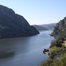
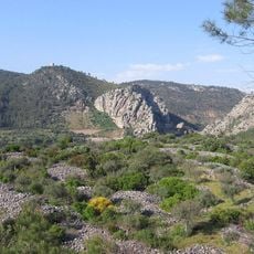
Serra das Talhadas is a mountain range between Alto Alentejo and Beira Baixa with multiple parallel ridges of quartzite rock and very steep slopes. The formation spans across the region and is shaped by two major rivers that have carved deep valleys through its terrain.
The mountain range contains evidence of ancient Roman gold mining operations, particularly around Conhal do Arneiro in Nisa municipality. This historical extraction shows how humans have used the resources beneath this terrain for many centuries.
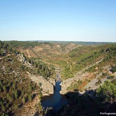
The mountain range contains four recognized geomonuments within Naturtejo Geopark, including the notable Portas do Almourão and Portas de Ródão formations.
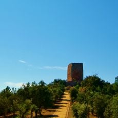
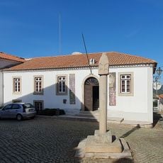
The range spreads across three municipalities and offers various hiking trails for different experience levels. Bring sturdy footwear and prepare for steep terrain and changing weather conditions.
The range contains four recognized geomonuments within Naturtejo Geopark, including remarkable rock formations called Portas do Almourão and Portas de Ródão. These natural features display the geological story written into the landscape in a distinctive way.
Elevation above the sea: 489 m
GPS coordinates: 39.70373,-7.71936
Latest update: December 14, 2025 18:04
Portas de Ródao Natural Monument
7 km
Castelo de Ródão
6.7 km
Conhal do Arneiro
8 km
Ponte das Portas de Ródão
7.2 km
Pelourinho de Vila Velha de Ródão
6.9 km
Casa de Artes e Cultura do Tejo
6.6 km
Igreja Matriz de Montes da Senhora
10.9 km
Igreja Matriz de Perais
13 km
Câmara Municipal de Vila Velha de Ródão
6.3 km
Igreja Paroquial de São Pedro do Esteval
13 km
Igreja Paroquial de Vila Velha de Ródão
6.2 km
Capela de Nossa Senhora da Guia
12.9 km
Lagar de Varas do Cabeço das Pesqueiras
7 km
Capela de Serrasqueira
7.7 km
Estação arqueológica da foz do Enxarique
7.3 km
Capela de Nossa Senhora do Castelo
6.6 km
Busto de Francisco dos Santos Pinto Cardoso
6.5 km
Igreja Paroquial de Fratel
8.8 km
Busto de Araújo Correia
8.8 km
Capela de Nossa Senhora da Piedade
1.5 km
CIART Centro de Interpretação de Arte Rupestre do Vale do Tejo
6.2 km
Chafariz e Lavadouro no Fratel
8.8 km
Portas de Almourão
4.3 km
Torre Sineira
12.9 km
Capela de Tostão
4.6 km
Ponte rodoviária sobre a Ribeira do Enxarrique
7 km
Capela de Santo Amaro
9.1 km
Capela de Nossa Senhora da Alagada
7.6 kmVisited this place? Tap the stars to rate it and share your experience / photos with the community! Try now! You can cancel it anytime.
Discover hidden gems everywhere you go!
From secret cafés to breathtaking viewpoints, skip the crowded tourist spots and find places that match your style. Our app makes it easy with voice search, smart filtering, route optimization, and insider tips from travelers worldwide. Download now for the complete mobile experience.
A unique approach to discovering new places❞
— Le Figaro
All the places worth exploring❞
— France Info
A tailor-made excursion in just a few clicks❞
— 20 Minutes