Enable Location

We need your location to show you interesting places around you

Discover nearby places

Find interesting locations and hidden gems around you

Precise directions

Get accurate directions and distances to places

Your location is never shared with other users. It's only used when you tap the location button.

Troitsk

Log in to your account

Start exploring — it's free

Trusted by 62,925 travelers worldwide

Continue with Google
Continue with Apple
or

We will send you a code to connect

By continuing, you accept our Terms and Conditions and our Privacy Policy

Check your inbox

We've sent a pincode in your inbox. Please enter the code below.

Discussion Reviews 1 Photos
104k Popularity

Troitsk, Research settlement in Troitsky Administrative Okrug, Russia.

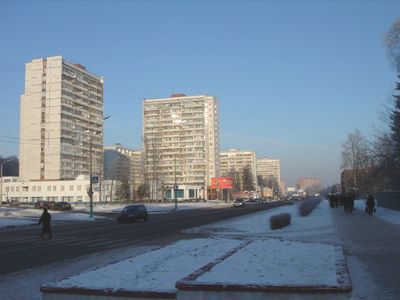
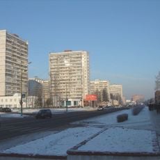
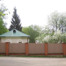
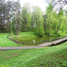
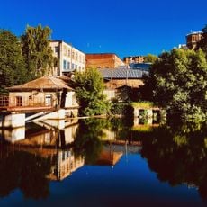
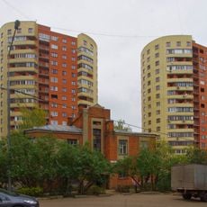
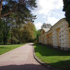
Troitsk is a settlement in Troitsky Administrative Okrug, roughly 37 kilometers southwest of central Moscow along the Desna River and Kaluzhskoye Highway. The settlement spreads over gentle terrain with multistory residential blocks, Soviet-era research buildings, and green spaces between the streets.

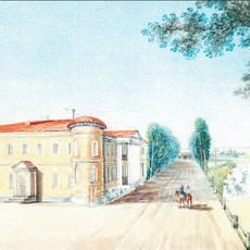
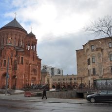
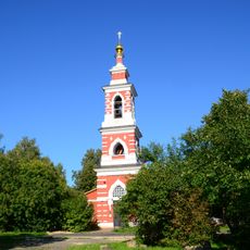
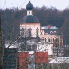
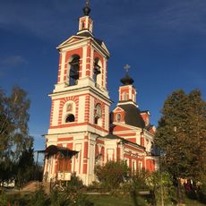
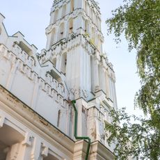
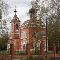
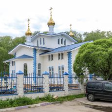
The settlement was first recorded in 1646 as Troitskoye, a village near a trinity church. It received town status in 1977 within Moscow Oblast and became part of Moscow city in 2012.

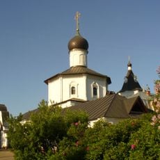
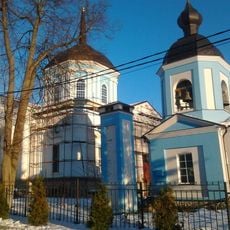
The name derives from the Russian word for trinity, reflected in the local church and several street names. Residential neighborhoods and research facilities sit close together, allowing scientists to walk between institutes and their homes.

Regular buses connect the settlement to central Moscow via the highway, covering the route in about an hour. Winter brings snow that makes sidewalks slippery, so sturdy footwear helps.

A particle accelerator operates below the surface, drawing physicists from different countries for experiments. Other institutes develop new diamond materials harder than natural diamonds.

The community of curious travelers

AroundUs brings together thousands of curated places, local tips, and hidden gems, enriched daily by 60,000 contributors worldwide.

Start exploring
Elevation above the sea
175 m
GPS coordinates
55.49139,37.30917
Latest update
December 12, 2025 23:08
Around this place
Valuevo Estate
Russian Federation

Valuevo Estate

9.6 km
Krasnoe estate
Russian Federation

Krasnoe estate

7.3 km
Polivanovo
Russian Federation

Polivanovo

7.4 km
Russian Federation

Institute for Spectroscopy Russian Academy of Sciences

3.1 km
Church of Archangel Michael in Stanislavle
Russian Federation

Church of Archangel Michael in Stanislavle

4.9 km
Filimonki estate
Russian Federation

Filimonki estate

7.5 km
Church of the Annunciation
Russian Federation

Church of the Annunciation

7.3 km
House of Scientists
Russian Federation

House of Scientists

1.9 km
Սուրբ Պայծառակերպության եկեղեցի
Russian Federation

Սուրբ Պայծառակերպության եկեղեցի

4.5 km
Парковый павильон («Охотничий домик») (Валуево)
Russian Federation

Парковый павильон («Охотничий домик») (Валуево)

9.4 km
Главный дом (Валуево)
Russian Federation

Главный дом (Валуево)

9.6 km
Дом при церкви (Валуево)
Russian Federation

Дом при церкви (Валуево)

9.4 km
Парк с прудами (Валуево)
Russian Federation

Парк с прудами (Валуево)

9.5 km
Церковь Рождества Христова (Варварино)
Russian Federation

Церковь Рождества Христова (Варварино)

7.6 km
Церковь Иоанна Богослова (Красное)
Russian Federation

Церковь Иоанна Богослова (Красное)

7.4 km
Church of the Theotokos of Kazan in Puchkovo
Russian Federation

Church of the Theotokos of Kazan in Puchkovo

2.7 km
Земляной редут русской армии (Красное)
Russian Federation

Земляной редут русской армии (Красное)

7 km
Holy Trinity Church in Filimonki
Russian Federation

Holy Trinity Church in Filimonki

7.7 km
Водонапорная башня английско-камвольной фабрики А.П. Прохорова (Э.Э. Купфера) (Троицк)
Russian Federation

Водонапорная башня английско-камвольной фабрики А.П. Прохорова (Э.Э. Купфера) (Троицк)

188 m
Church of the Protection of the Theotokos in Bolshoye Pokrovskoye
Russian Federation

Church of the Protection of the Theotokos in Bolshoye Pokrovskoye

9.5 km
Главный дом (Красное)
Russian Federation

Главный дом (Красное)

7.3 km
Башня водонапорная с водоочистными сооружениями (Валуево)
Russian Federation

Башня водонапорная с водоочистными сооружениями (Валуево)

9.6 km
Nagornaya street, 2 (Troitsk, Moscow)
Russian Federation

Nagornaya street, 2 (Troitsk, Moscow)

615 m
Парк (Троицк)
Russian Federation

Парк (Троицк)

473 m
Двухэтажный флигель (южный с галереей) (Валуево)
Russian Federation

Двухэтажный флигель (южный с галереей) (Валуево)

9.6 km
Church of the Theotokos Quick-to-Hear in Maryino
Russian Federation

Church of the Theotokos Quick-to-Hear in Maryino

6.3 km
Гроты (два) (Валуево)
Russian Federation

Гроты (два) (Валуево)

9.4 km
Конный двор (два корпуса) (Валуево)
Russian Federation

Конный двор (два корпуса) (Валуево)

9.6 km
Show the full map
Reviews
Share your experience

No review yet

Discussions
Start a discussion...

No discussion yet

« Troitsk - Research settlement in Troitsky Administrative Okrug, Russia » is provided by Around Us (aroundus.com). Images and texts are derived from Wikimedia project under a Creative Commons license. You are allowed to copy, distribute, and modify copies of this page, under the conditions set by the license, as long as this note is clearly visible.

Discover hidden gems everywhere you go!

From secret cafés to breathtaking viewpoints, skip the crowded tourist spots and find places that match your style. Our app makes it easy with voice search, smart filtering, route optimization, and insider tips from travelers worldwide. Download now for the complete mobile experience.

Around Us App Screenshot

A unique approach to discovering new places

Le Figaro

All the places worth exploring

France Info

A tailor-made excursion in just a few clicks

20 Minutes

Around Us
Travel Guide & Maps
Download

Send to your phone

QR Code
1

Open the camera app on your mobile.

2

Point at the QR code with your camera. A notification will appear.

3

Tap the notification to open the link.