Öreryd 16:1, building in Gislaved Municipality, Jönköping County, Sweden
Location: Gislaved Municipality
GPS coordinates: 57.44008,13.64065
Latest update: November 24, 2023 23:09
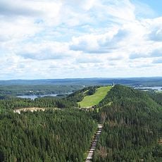
Isaberg
1.9 km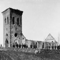
Källeryds kyrka
3.4 km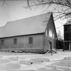
Norra Hestra Church
3.1 km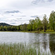
Algustorpasjön
1.8 km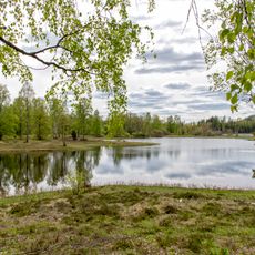
Ettö
411 m
Värö
1.7 km
Klosjön
3.8 km
Norra Hestra 5:1
2.9 km
Hjulvhult 2:1
1.8 km
Öreryd 117:2
336 m
Källeryd 8:1
3.6 km
Öreryd 105:1
3.9 km
Öreryd 51:1
138 m
Källeryd 14:1
2.4 km
Källeryd 13:2
2.5 km
Källeryd 13:1
2.5 km
Norra Hestra 2:1
2.9 km
Norra Hestra hembygdsgård
3.2 km
Ulvs Rör
2.6 km
Källeryd 71:1
2.2 km
Öreryd 117:1
323 m
Öreryd 118:1
231 m
Källeryd 9:1
3.5 km
Källeryd 15:1
3.7 km
Källeryd 7:1
3.7 km
Öreryd 118:2
233 m
Källeryd 6:1
4 km
Scenic viewpoint
2 kmReviews
Visited this place? Tap the stars to rate it and share your experience / photos with the community! Try now! You can cancel it anytime.
Discover hidden gems everywhere you go!
From secret cafés to breathtaking viewpoints, skip the crowded tourist spots and find places that match your style. Our app makes it easy with voice search, smart filtering, route optimization, and insider tips from travelers worldwide. Download now for the complete mobile experience.

A unique approach to discovering new places❞
— Le Figaro
All the places worth exploring❞
— France Info
A tailor-made excursion in just a few clicks❞
— 20 Minutes