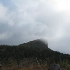
Kall 70:3, hällmålning i Jämtland
Location: Åre Municipality
GPS coordinates: 63.69048,13.41167
Latest update: November 22, 2025 05:49
Suljätten
17.1 km
Oldsjön
11.5 km
Finningsvalen
8.5 km
Oldklumpens naturreservat
7.8 km
Tvärån Piktjärn
12.4 km
Gåstjärnvalen
9.1 km
Duvvegaise
14.4 km
Daletjahke
13.6 km
Gruffjället
10.7 km
Gurpe
8.9 km
Dåresvare
20.2 km
Plassagaise
14.6 km
Skurebakte
19.8 km
Snåltjentjarve
15 km
Vetjeretjuole
19.5 km
Storbyfjället
9.3 km
Svalevajje
18 km
Suohpedetjahke
19 km
Kall 673
5.1 km
Mälkantjahke
20.2 km
Bielkröset
10.2 km
Kall 70:4
6 m
Kall 70:5
12 m
Kall 70:2
4 m
Kall 70:1
10 m
Private Golf Course
4.6 km
Oldens kristallgruva
11 km
Waterfall
18.8 kmReviews
Visited this place? Tap the stars to rate it and share your experience / photos with the community! Try now! You can cancel it anytime.
Discover hidden gems everywhere you go!
From secret cafés to breathtaking viewpoints, skip the crowded tourist spots and find places that match your style. Our app makes it easy with voice search, smart filtering, route optimization, and insider tips from travelers worldwide. Download now for the complete mobile experience.

A unique approach to discovering new places❞
— Le Figaro
All the places worth exploring❞
— France Info
A tailor-made excursion in just a few clicks❞
— 20 Minutes