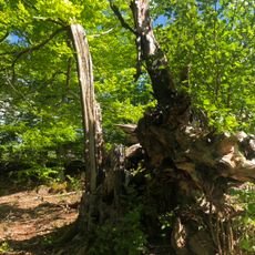
Virestad 148:2, stenkammargrav i Småland
Location: Älmhult Municipality
GPS coordinates: 56.63992,14.30808
Latest update: November 17, 2025 06:14
Stubbalyckeboken, Stubbalycke 1:2
3.2 km
Virestad 133:1
2.4 km
Virestad 263:1
3.6 km
Två ekar, Virestadsekarna
3 km
En solitärek, Spånghultseken
2.3 km
Jättakistan på trädan
1.1 km
Virestad 30:1
2.5 km
Virestad 300:1
2.9 km
Virestad 267:1
3.5 km
Virestad 103:1
3.6 km
Virestad 148:1
25 m
Virestad 149:1
83 m
Smedjan i Kvarnatorp
2 km
Virestad 123:1
1.9 km
Virestad 132:1
2.3 km
Virestad 253:1
2.6 km
Virestad 260:2
3 km
Liatorps Smf m. ångsåg och Linas stuga
3.5 km
Virestad 264:1
3.5 km
Virestad 242:1
1.1 km
Virestad 226:1
3.1 km
Virestad 30:2
2.4 km
Virestad 259:1
3.1 km
Korsberget
2.2 km
Virestad 256:1
3.1 km
Stora Krunan
849 m
Virestad 39:1
2.8 km
Virestad 260:1
3 kmReviews
Visited this place? Tap the stars to rate it and share your experience / photos with the community! Try now! You can cancel it anytime.
Discover hidden gems everywhere you go!
From secret cafés to breathtaking viewpoints, skip the crowded tourist spots and find places that match your style. Our app makes it easy with voice search, smart filtering, route optimization, and insider tips from travelers worldwide. Download now for the complete mobile experience.

A unique approach to discovering new places❞
— Le Figaro
All the places worth exploring❞
— France Info
A tailor-made excursion in just a few clicks❞
— 20 Minutes