Karl Gustav 278:1, stensättning i Norrbotten
Location: Haparanda Municipality
GPS coordinates: 66.11399,23.92942
Latest update: November 17, 2025 08:25
Hietaniemi Church
15 km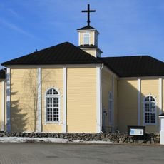
Karunki Church
9 km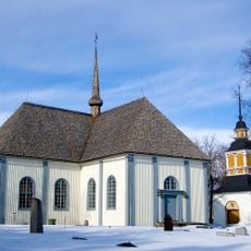
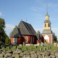
Karl Gustavs kyrka, Norrbotten
7.8 km
Konsthall Tornedalen
10.2 km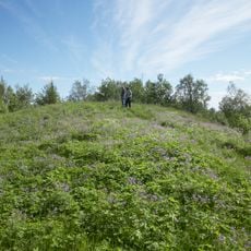
Perävaara
10.7 km
Tornedalens Fiskemuseum
17.3 km
Kannala
13.8 km
Prinsristningen
3.8 km
Ossaukoski
13.8 km
Matkakoski
4.1 km
Kukkola fiskemuseum
17.3 km
Karl Gustav 261:1
15.2 km
Karl Gustav 99:1
4 km
Hietaniemi 83:1
15 km
Gränsmärke
14.9 km
Memorial
6.8 km
Memorial
16.7 km
Memorial
14.7 km
Archaeological site
12.4 km
Archaeological site
16.3 km
Archaeological site
14.6 km
Archaeological site
1 km
Archaeological site
1.6 km
Archaeological site
16.1 km
Archaeological site
15.7 km
Archaeological site
15.9 km
Sankaripatsas
9 km
Waterfall
7.6 kmReviews
Visited this place? Tap the stars to rate it and share your experience / photos with the community! Try now! You can cancel it anytime.
Discover hidden gems everywhere you go!
From secret cafés to breathtaking viewpoints, skip the crowded tourist spots and find places that match your style. Our app makes it easy with voice search, smart filtering, route optimization, and insider tips from travelers worldwide. Download now for the complete mobile experience.

A unique approach to discovering new places❞
— Le Figaro
All the places worth exploring❞
— France Info
A tailor-made excursion in just a few clicks❞
— 20 Minutes