Jokkmokk 1700:1, stensättning i Lappland
Location: Jokkmokk Municipality
GPS coordinates: 66.78418,19.97049
Latest update: November 12, 2025 17:25
Muddus National Park
17.7 km
Luleälvsbron
16.2 km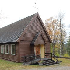
Porjus kyrka
20.4 km
Hästkullen
20.3 km
Hemberget
15.5 km
Ligga
9.7 km
Såkåive
8.3 km
Tilak
18.3 km
Miessaureape
18.9 km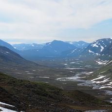
Tall Sarkavare
17.6 km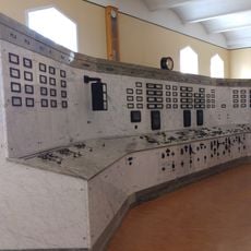
Porjus gamla kraftstation, Porjus expo
20.2 km
Laponia
17 km
Scenic viewpoint
12.2 km
Scenic viewpoint
12.3 km
Harsprångsfallet
12.4 km
Scenic viewpoint
8.6 km
Scenic viewpoint
8.6 km
Scenic viewpoint
12.2 km
Scenic viewpoint
8.6 km
Scenic viewpoint
12.2 km
Scenic viewpoint
12.4 km
Scenic viewpoint
12.3 km
Ananasse
9.5 km
Scenic viewpoint
10.4 km
Waterfall
8.7 km
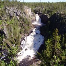
Muddusfallet
8.7 km
Askasfallet
8.5 km
Waterfall
10.5 kmReviews
Visited this place? Tap the stars to rate it and share your experience / photos with the community! Try now! You can cancel it anytime.
Discover hidden gems everywhere you go!
From secret cafés to breathtaking viewpoints, skip the crowded tourist spots and find places that match your style. Our app makes it easy with voice search, smart filtering, route optimization, and insider tips from travelers worldwide. Download now for the complete mobile experience.

A unique approach to discovering new places❞
— Le Figaro
All the places worth exploring❞
— France Info
A tailor-made excursion in just a few clicks❞
— 20 Minutes