Tvärred 273:1, hällristning i Västergötland
Location: Ulricehamn Municipality
GPS coordinates: 57.72567,13.23261
Latest update: November 24, 2023 23:10
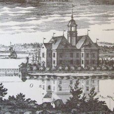
Sundholmen Castle
3.4 km
Rölle
3.2 km
Tvärred 41:2
3.6 km
Jättastugan
2.9 km
Lergered Mellomgården 2:7
2.5 km
Äspered 50:3
3.7 km
Tvärred 49:1
3.6 km
Dannike 44:2
2.3 km
Äspered 50:2
3.7 km
Toarp 2:2
3.1 km
Äspered 50:1
3.7 km
Tvärred 258:1
1.5 km
Tvärred 48:3
3.5 km
Tvärred 22:1
3.5 km
Tvärred 48:2
3.5 km
Dannike 11:2
2.4 km
Toarp 74:1
3.1 km
Tvärred 23:1
3.6 km
Dannike 11:4
2.4 km
Äspered 2:2
3.4 km
Tvärred 48:1
3.5 km
Äspered 2:3
3.4 km
Dannike 80
3.2 km
Toarp 2:1
3.1 km
Dannike 11:1
2.4 km
Tvärred 26:1
3.6 km
Dannike 11:3
2.4 km
Dannike 44:1
2.2 kmReviews
Visited this place? Tap the stars to rate it and share your experience / photos with the community! Try now! You can cancel it anytime.
Discover hidden gems everywhere you go!
From secret cafés to breathtaking viewpoints, skip the crowded tourist spots and find places that match your style. Our app makes it easy with voice search, smart filtering, route optimization, and insider tips from travelers worldwide. Download now for the complete mobile experience.

A unique approach to discovering new places❞
— Le Figaro
All the places worth exploring❞
— France Info
A tailor-made excursion in just a few clicks❞
— 20 Minutes