Ljung 42:1, röse i Bohuslän
Location: Uddevalla Municipality
GPS coordinates: 58.19774,11.91022
Latest update: October 25, 2025 16:17
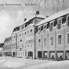
Svenshögens Sanatorium
6.7 km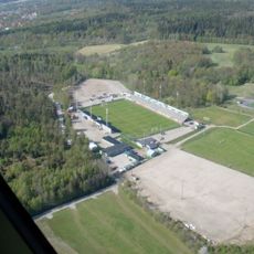
Markbygg Arena
2.9 km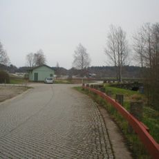
Road at Åsen on old Highway 2
2.2 km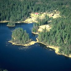
Bredfjället
6.5 km
Ljung 84:1
2.2 km
Myckleby 188:1
3.8 km
Grinneröd 23:1
4.6 km
Ljung 48:2
704 m
Myckleby 57:1
4.8 km
Myckleby 88:1
6.2 km
Resteröd 11:1
7 km
Grinneröd 7:1
4.1 km
Ljung 50:1
1.1 km
Resteröd 68:1
6.9 km
Grinneröd 7:2
4.1 km
Myckleby 85:1
6.5 km
Långelanda 119:1
6.2 km
Ljung 55:1
1.3 km
Myckleby 219
4.3 km
Ödsmål 131:1
6.9 km
Långelanda 123:1
7.1 km
Resteröd 26:1
6.6 km
Resteröd 29:1
5.2 km
Lindholmen
3.9 km
Work of art, sculpture
3 km
Statue, Work of art
2.9 km
Scenic viewpoint
1.2 km
Scenic viewpoint
5 kmReviews
Visited this place? Tap the stars to rate it and share your experience / photos with the community! Try now! You can cancel it anytime.
Discover hidden gems everywhere you go!
From secret cafés to breathtaking viewpoints, skip the crowded tourist spots and find places that match your style. Our app makes it easy with voice search, smart filtering, route optimization, and insider tips from travelers worldwide. Download now for the complete mobile experience.

A unique approach to discovering new places❞
— Le Figaro
All the places worth exploring❞
— France Info
A tailor-made excursion in just a few clicks❞
— 20 Minutes