Naverstad 310:1, röse i Bohuslän
Location: Tanum Municipality
GPS coordinates: 58.76003,11.46057
Latest update: October 25, 2025 21:03
Gemeinde Tanum
2.8 km
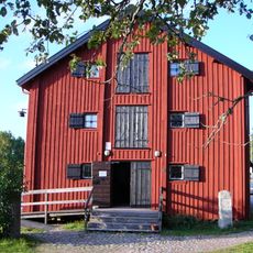
Tanums Hällristningsmuseum
4.3 km
Tanum 148:1
4.3 km
Tanum 271:1
4 km
Tanum 872:6
5.6 km
Tanum 872:5
5.7 km
Tanum 872:3
5.6 km
Tanum 872:2
5.6 km
Tanum 301:1
4.4 km
Tanum 872:1
5.6 km
Tanum 267:1
5.6 km
Tanum 272:1
5.3 km
Tanum 273:1
5 km
Naverstad 179:1
5.6 km
Tanum 268:1
5.5 km
Tanum 871:2
5.6 km
Tanum 269:1
5.5 km
Tanum 871:1
5.6 km
Tanum 300:1
4 km
Tanum 871:3
5.6 km
Tanum 871:4
5.6 km
Tanum 275:1
4.1 km
Tanum 270:1
5.4 km
Tanum 266:1
5.6 km
Tanum 872:4
5.6 km
Tanum 274:1
4.8 km
Naverstad 175:1
4.2 km
Tanum 807:1
4.5 kmReviews
Visited this place? Tap the stars to rate it and share your experience / photos with the community! Try now! You can cancel it anytime.
Discover hidden gems everywhere you go!
From secret cafés to breathtaking viewpoints, skip the crowded tourist spots and find places that match your style. Our app makes it easy with voice search, smart filtering, route optimization, and insider tips from travelers worldwide. Download now for the complete mobile experience.

A unique approach to discovering new places❞
— Le Figaro
All the places worth exploring❞
— France Info
A tailor-made excursion in just a few clicks❞
— 20 Minutes