Västerås 195:1, hällristning i Västmanland
Location: Västerås Municipality
GPS coordinates: 59.64900,16.63224
Latest update: October 25, 2025 15:01
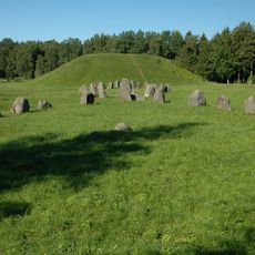
Anundshög
2.2 km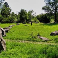
Runsa stone ship
2.2 km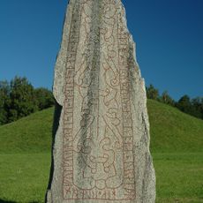
Anundstenen
2.3 km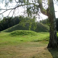
Badelunda
889 m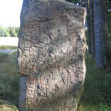
Västmanlands runinskrifter Fv1988;36
1.5 km
Västerås 187:3
357 m
Hubbo 179:1
2.2 km
Hubbo 179:2
2.2 km
Västerås 465:2
2.5 km
Västerås 196:2
956 m
Västerås 186:1
310 m
Västerås 570:1
1.8 km
Västerås 198:1
758 m
Västerås 572:1
2.3 km
Västerås 572:2
2.3 km
Rävbacken
749 m
Västerås 946:1
2.6 km
Västerås 1246
7 m
Hubbo 139:1
2.4 km
Västerås 187:1
337 m
Västerås 413:1
1.9 km
Hubbo 138:1
2.4 km
Västerås 484:2
684 m
Västerås 465:1
2.5 km
Västerås 414:1
2.6 km
Tillberga 37:5
2 km
Tillberga 166:1
2.7 km
Tillberga 166:2
2.7 kmReviews
Visited this place? Tap the stars to rate it and share your experience / photos with the community! Try now! You can cancel it anytime.
Discover hidden gems everywhere you go!
From secret cafés to breathtaking viewpoints, skip the crowded tourist spots and find places that match your style. Our app makes it easy with voice search, smart filtering, route optimization, and insider tips from travelers worldwide. Download now for the complete mobile experience.

A unique approach to discovering new places❞
— Le Figaro
All the places worth exploring❞
— France Info
A tailor-made excursion in just a few clicks❞
— 20 Minutes