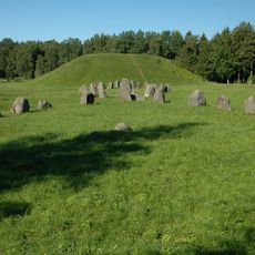
Västerås 550:1, röse i Västmanland
Location: Västerås Municipality
GPS coordinates: 59.62032,16.68176
Latest update: October 25, 2025 18:41
Anundshög
2.3 km
Runsa stone ship
2.3 km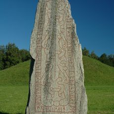
Anundstenen
2.3 km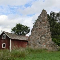
Furby kyrkoruin
2.3 km
Irsta 1:4
1.5 km
Irsta 73:1
2.2 km
Irsta 360:1
2.4 km
Irsta 77:6
2.5 km
Irsta 262:1
2.3 km
Västerås 779:1
2.3 km
Irsta 345:2
2.3 km
Irsta 76:3
2.6 km
Irsta 346:1
2.2 km
Västerås 552:2
1.4 km
Västerås 503:1
2.3 km
Irsta 386:1
2.2 km
Irsta 329:1
1.1 km
Irsta 22:1
2.2 km
Irsta 29:1
1.8 km
Västerås 552:3
1.4 km
Västerås 177:1
2.5 km
Irsta 402:2
967 m
Västerås 501:1
2.4 km
Västerås 546:1
915 m
Irsta 345:1
2.3 km
Västerås 504:1
2.2 km
Västerås 515:2
2.6 km
Scenic viewpoint
2.3 kmReviews
Visited this place? Tap the stars to rate it and share your experience / photos with the community! Try now! You can cancel it anytime.
Discover hidden gems everywhere you go!
From secret cafés to breathtaking viewpoints, skip the crowded tourist spots and find places that match your style. Our app makes it easy with voice search, smart filtering, route optimization, and insider tips from travelers worldwide. Download now for the complete mobile experience.

A unique approach to discovering new places❞
— Le Figaro
All the places worth exploring❞
— France Info
A tailor-made excursion in just a few clicks❞
— 20 Minutes