Lomselet, nature reserve in Västerbotten, Sweden
Location: Malå Municipality
Inception: March 10, 1997
GPS coordinates: 65.14150,18.87905
Latest update: November 16, 2025 14:34
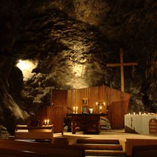
Sankta Anna Underjordskyrka
16.8 km
Koppsele
21.3 km
Storsele
6.1 km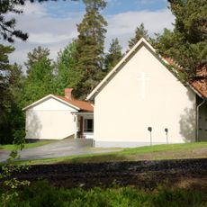
Kristineberg Church
16.5 km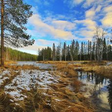
Malå-Storforsen
13.9 km
Rävlidengruvan
20.1 km
Rävliden
22 km
Avaås
23.3 km
Rismyran
12.8 km
Lillträskberget
24.7 km
Norravasund
1 km
Åheden
24.1 km
Brännträsk
12.4 km
Forsbergsbrännan
14.8 km
Strömfors
4.7 km
Sodoberg
19 km
Vågträsk
20.4 km
Kåtamyrans naturreservat
24.2 km
Kallkälltegen
21.2 km
Näsuddsberget
6.5 km
Fågelmyrkölen
15.3 km
Kroktjärnen
24 km
Mörtträskheden
21.7 km
Sankta Anna Underjordskyrka
16.8 km
Malå 1306
16 km
Malå 1274:1
18 km
Malå 1497
17 km
Forum
7.9 kmReviews
Visited this place? Tap the stars to rate it and share your experience / photos with the community! Try now! You can cancel it anytime.
Discover hidden gems everywhere you go!
From secret cafés to breathtaking viewpoints, skip the crowded tourist spots and find places that match your style. Our app makes it easy with voice search, smart filtering, route optimization, and insider tips from travelers worldwide. Download now for the complete mobile experience.

A unique approach to discovering new places❞
— Le Figaro
All the places worth exploring❞
— France Info
A tailor-made excursion in just a few clicks❞
— 20 Minutes