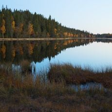
2004080 Tall, naturminne i Borlänge kommun
Location: Borlänge Municipality
Inception: December 31, 1945
GPS coordinates: 60.40292,15.18048
Latest update: November 21, 2025 11:09
Gyllbergen
3.4 km
Spånsanmasten
3.3 km
Idkerbergets kapell
3.9 km
2004083 (W-id) Tall
77 m
2004082 (W-id) Tall
81 m
2004078 (W-id) Flyttblock "Jättebordet"
2 km
2004084 (W-id) Grangrupp av 7 stammar
2.5 km
2004081 (W-id) Tall
12 m
2004123 (W-id) En tall
3 km
Backnora
3.2 km
Smeds fäbodar
2.9 km
Stora Tuna 820:1
4.8 km
Dragsbergsfäbodarna
3.7 km
Linds fäbodar
2.1 km
Svartå fäbodar
2.4 km
Hols fäbodar
3 km
Stora Tuna 709:1
3.1 km
Nya Idkerbergsfäbodarna
3.2 km
Åselbyfäbodarna
2.1 km
Prysstäktens fäbodar
2.8 km
Gamla Idkerbergsfäbodarna
3.1 km
Stora Tuna 1015
2.7 km
Älbergets fäbod
3.5 km
Backnora
3.4 km
Kölnäs fäbod
4.3 km
Långhagsfäbodarna
5 km
Gyllfäbodarna
223 m
Hyttings fäbodar
4.9 kmReviews
Visited this place? Tap the stars to rate it and share your experience / photos with the community! Try now! You can cancel it anytime.
Discover hidden gems everywhere you go!
From secret cafés to breathtaking viewpoints, skip the crowded tourist spots and find places that match your style. Our app makes it easy with voice search, smart filtering, route optimization, and insider tips from travelers worldwide. Download now for the complete mobile experience.

A unique approach to discovering new places❞
— Le Figaro
All the places worth exploring❞
— France Info
A tailor-made excursion in just a few clicks❞
— 20 Minutes