Ett enträd, Fridsberg 1:1, naturminne i Tingsryds kommun
Location: Tingsryd Municipality
Inception: May 8, 1947
GPS coordinates: 56.47527,14.92636
Latest update: November 3, 2025 14:52
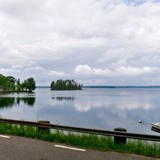
Mien
7.7 km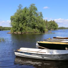
Tiken
4 km
Stenfors
2.9 km
Ramsö
7.9 km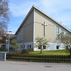
Söderportkyrkan, Tingsryd
6.2 km
Älganäs
3.2 km
Grönvik
8.3 km
Prästastenen
7.2 km
Tingsås 400:1
4.9 km
En ek, Ekeberg 1:13
7.9 km
En gnejshäll, "Oxahall"
7 km
Kungastenarna
6 km
Södra Sandsjö 11:1
8.9 km
Tingsås 84:1
4.1 km
Tingsås 95:1
2.5 km
Bastaremåla blockfält
6.3 km
Södra Sandsjö 25:1
9 km
Två tallar
6 km
Tingsås 96:1
4.1 km
Södra Sandsjö 108:1
7.7 km
Tingsås 400:2
4.9 km
Tingsås 133:1
6.4 km
Tingsås 208:1
7.4 km
Törnemåla kvarn
1.2 km
Tomtaröset
8.8 km
Väckelsång 140:1
8.6 km
Väckelsång 140:2
8.6 km
Laxasands badplats
8.1 kmReviews
Visited this place? Tap the stars to rate it and share your experience / photos with the community! Try now! You can cancel it anytime.
Discover hidden gems everywhere you go!
From secret cafés to breathtaking viewpoints, skip the crowded tourist spots and find places that match your style. Our app makes it easy with voice search, smart filtering, route optimization, and insider tips from travelers worldwide. Download now for the complete mobile experience.

A unique approach to discovering new places❞
— Le Figaro
All the places worth exploring❞
— France Info
A tailor-made excursion in just a few clicks❞
— 20 Minutes