Klippartiet Klintahallar, naturminne i Olofströms kommun
Location: Olofström Municipality
Inception: February 25, 1939
GPS coordinates: 56.39852,14.54285
Latest update: November 24, 2023 23:13

Fox Hill, Highest point in Blekinge
4.9 km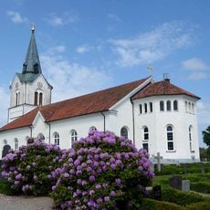
Kyrkhult Church
5.6 km
Mulatorp
4 km
Fridafors Kirke
7.1 km
Siggaboda
6.3 km
Albertas myr
7.6 km
Böke myr
7.4 km
Kullan
7.2 km
Åmma
7.2 km
Siggaboda södra
5.7 km
Kyrkhult 22:1
4.2 km
Kyrkhult 3:1
6.3 km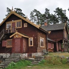
Forneboda
5.8 km
Ett flyttblockskomplex St Bäckasjön
303 m
Kyrkhult 864
2.6 km
Kyrkhults hembygdsmuseum
5.9 km
Kyrkhult 21:1
5.9 km
Kyrkhult 5:1
3.7 km
Örkened 11:1
7.5 km
Bokdunge i Rönhult
7.5 km
Kyrkhult 831
6.2 km
Stenlängan i Vilshult
6.6 km
Kyrkhult 761
5.7 km
Kyrkhult 6:1
4.8 km
Kyrkhult 181
3.9 km
Arons Berg Museum
2.9 km
Kyrkhult 468
8 km
Medicinal spring Kyrkhult
6.4 kmReviews
Visited this place? Tap the stars to rate it and share your experience / photos with the community! Try now! You can cancel it anytime.
Discover hidden gems everywhere you go!
From secret cafés to breathtaking viewpoints, skip the crowded tourist spots and find places that match your style. Our app makes it easy with voice search, smart filtering, route optimization, and insider tips from travelers worldwide. Download now for the complete mobile experience.

A unique approach to discovering new places❞
— Le Figaro
All the places worth exploring❞
— France Info
A tailor-made excursion in just a few clicks❞
— 20 Minutes