
Kyrkhult 831, Reste einer ehemaligen Siedlung im Socken Kyrkhult (heute Gemeinde Olofström), Schweden
Location: Olofström Municipality
GPS coordinates: 56.39415,14.64375
Latest update: November 23, 2025 06:33

Helikopterolyckan i Ryd
8 km
Fox Hill, Highest point in Blekinge
8.8 km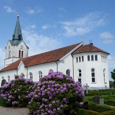
Kyrkhult Church
5.5 km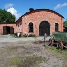
Ebbamåla bruk
3.5 km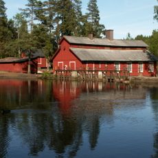
Hyltén's industrial museum
3.5 km
Fridafors Kirke
1.8 km
Käringahejan
5.8 km
Siggaboda
8.7 km
Åmma
982 m
Siggaboda södra
8.2 km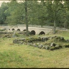
Ringamåla 7:1
8 km
Ett flyttblockskomplex St Bäckasjön
6 km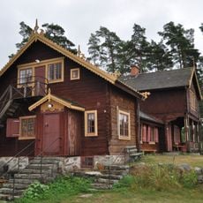
Forneboda
4.7 km
Ringamåla 324
7.5 km
Jätte fjät och-gryta Skrubbebodaån
8.2 km
Kung Hönas sten
9.2 km
Kyrkhult 864
7.9 km
Kyrkhults hembygdsmuseum
5.6 km
Klippartiet Klintahallar
6.2 km
Kyrkhult 5:1
5.9 km
Ormgran i Balders hage, Ryd
8.9 km
Arons Berg Museum
7.7 km
Kyrkhult 6:1
3.8 km
Kyrkhult 761
2.2 km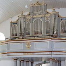
Almundsryds kyrkas orgel by Magnusson and Johansson
8.4 km
Ringamåla 1:1
2 km
Almundsryd 125:1
5.6 km
Scenic viewpoint
7.7 kmReviews
Visited this place? Tap the stars to rate it and share your experience / photos with the community! Try now! You can cancel it anytime.
Discover hidden gems everywhere you go!
From secret cafés to breathtaking viewpoints, skip the crowded tourist spots and find places that match your style. Our app makes it easy with voice search, smart filtering, route optimization, and insider tips from travelers worldwide. Download now for the complete mobile experience.

A unique approach to discovering new places❞
— Le Figaro
All the places worth exploring❞
— France Info
A tailor-made excursion in just a few clicks❞
— 20 Minutes