Bralová skala

Log in to your account

AroundUs is a community-driven map of interesting places, built by curious explorers like you. It grows with every review, story, and photo you share.
Connect to save your favorite spots, contribute locations, and create personalized routes.
Continue with Google
Continue with Apple
Continue with X
Continue with Facebook
Continue with email
By continuing, you accept our Terms and Conditions and our Privacy Policy
Create an account

Bralová skala

Add to collection
Map
Suggest a change
Share

Bralová skala, Mountain peak in Prievidza District, Slovakia.

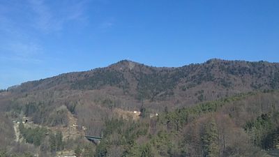
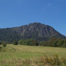
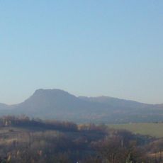
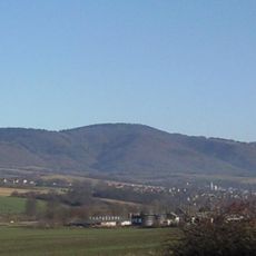
Bralová skala is a peak in the Žiar Mountains rising to 826 meters, marked by steep rock faces and a transmission station at its summit. The formation consists of distinct stone walls crossed by marked hiking paths that connect different regions.

During the Slovak National Uprising, this peak served as a strategic observation post for regional defense efforts. After the war, it became integrated into a hiking network that honors those events.

Local climbers have established several routes on the rock faces, which today serve climbers and hikers exploring the area. The rock formation draws people who want to test themselves against the stone.

A yellow-marked trail from the Remata recreational area leads through forest paths to the summit, taking about 50 minutes to hike. The route is well-marked and suitable for hikers with basic mountain experience.

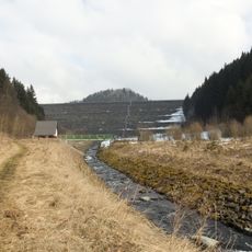
A three-kilometer railway tunnel runs directly beneath the mountain, connecting the regions of Horná Nitra and Turčianska underground. This hidden transportation link shows how modern infrastructure passes beneath the natural landscape.

Location: Prievidza District

Location: Turčianske Teplice District

Elevation above the sea: 826 m

GPS coordinates: 48.76248,18.81201

Latest update: December 14, 2025 16:42

Photos
Reviews

Visited this place? Tap the stars to rate it and share your experience / photos with the community! Try now! You can cancel it anytime.

« Bralová skala - Mountain peak in Prievidza District, Slovakia » is provided by Around Us (aroundus.com). Images and texts are derived from Wikimedia project under a Creative Commons license. You are allowed to copy, distribute, and modify copies of this page, under the conditions set by the license, as long as this note is clearly visible.

Discover hidden gems everywhere you go!

From secret cafés to breathtaking viewpoints, skip the crowded tourist spots and find places that match your style. Our app makes it easy with voice search, smart filtering, route optimization, and insider tips from travelers worldwide. Download now for the complete mobile experience.

Around Us App Screenshot

A unique approach to discovering new places

Le Figaro

All the places worth exploring

France Info

A tailor-made excursion in just a few clicks

20 Minutes